
Good evening, everyone. It’s been a while since I’ve shared a weather update here on the website. We’re currently keeping a close eye on the potential for a major winter storm this weekend, so let’s jump right in.
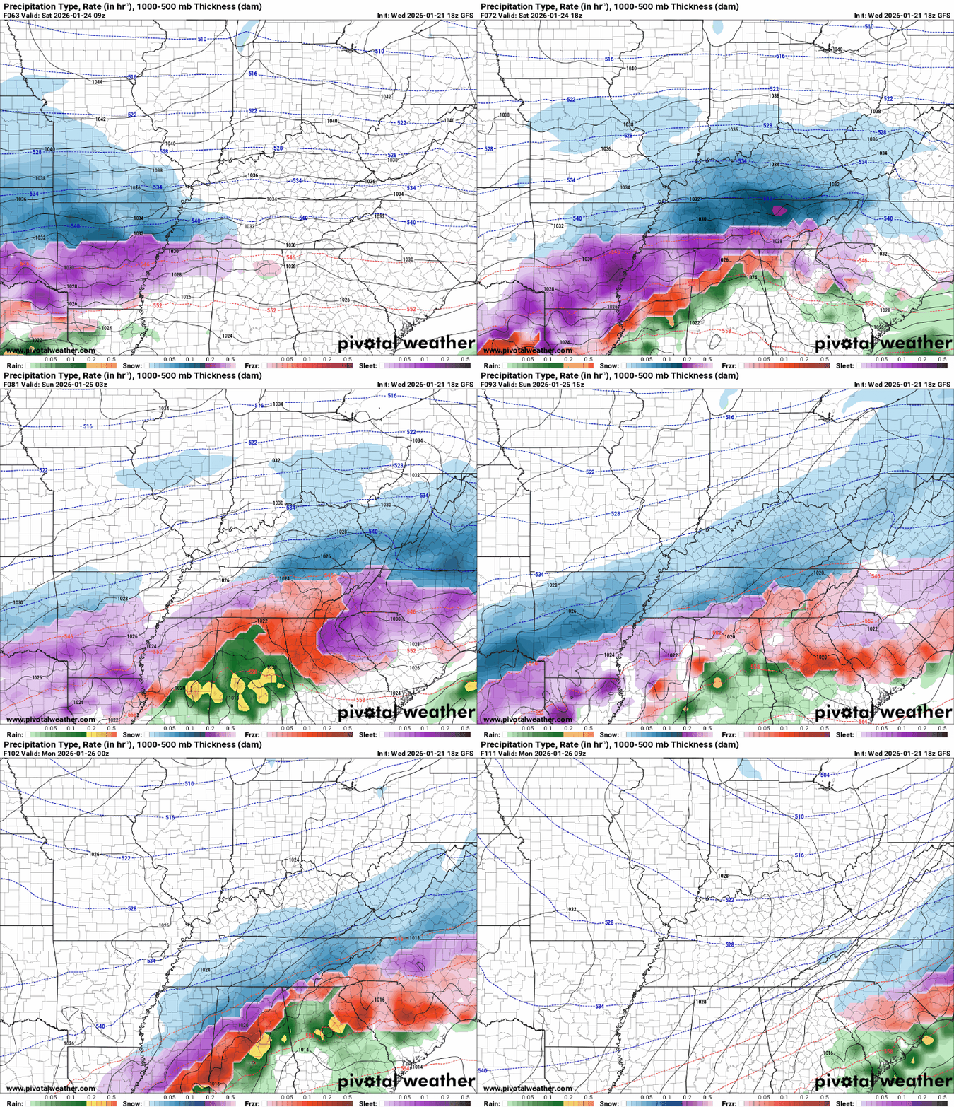 Starting with the GFS model, it has remained fairly consistent in showing a heavy blanket of snow across the Lake Cumberland area. Call me crazy, but this is the scenario I’m rooting for, and I’ll explain why in just a moment.

The GFS continues to generate some eye-opening snow totals for the region. Do I expect amounts like this? I’ve been saying no, but if these signals persist as we get closer to the event, that stance may need to change.
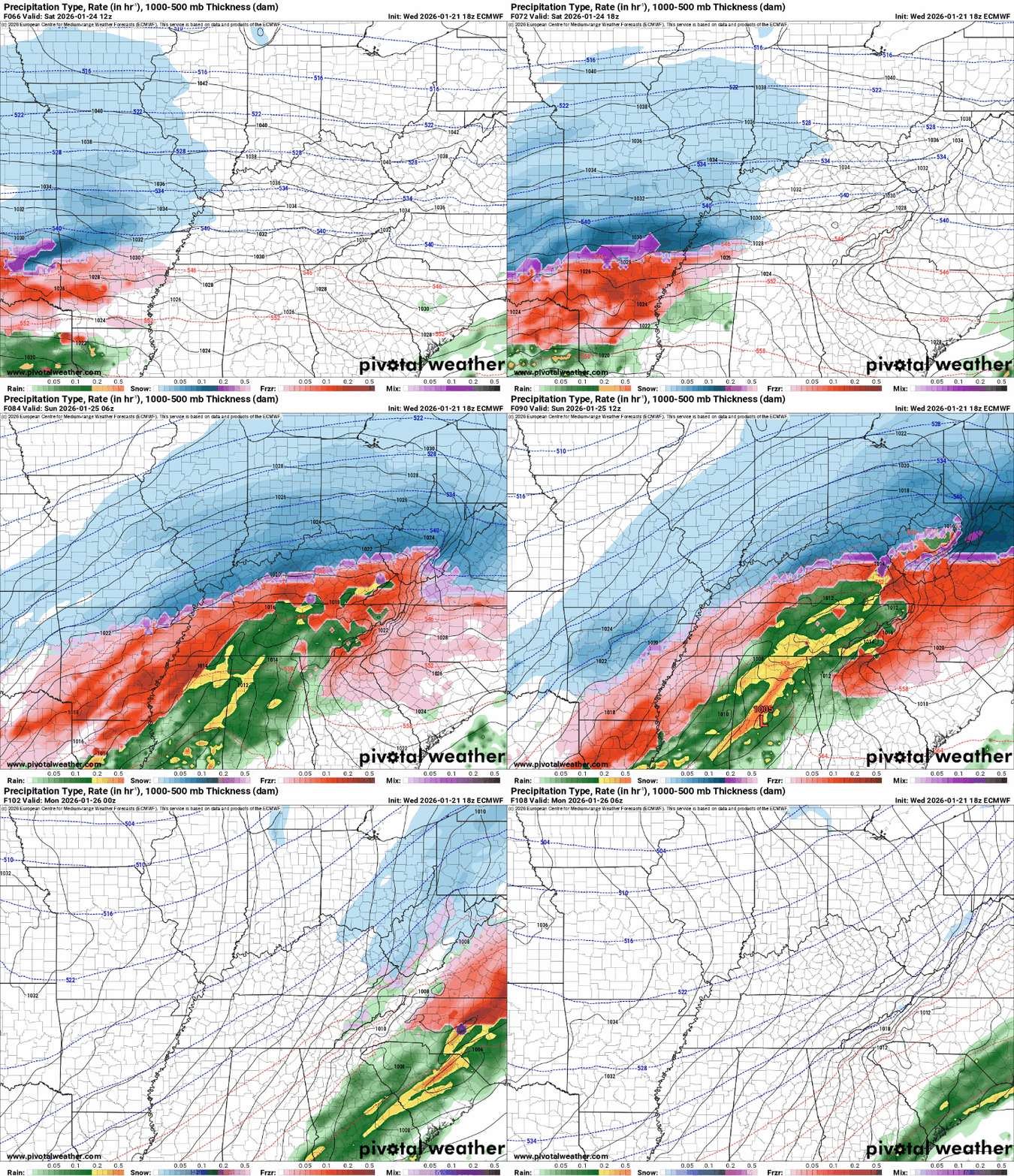
Shifting over to the European model, this is where some concern comes into play. The Euro is indicating the potential for mixed precipitation, which could introduce ice accumulation. Personally, I’d take a foot of snow over an inch of ice any day of the week.
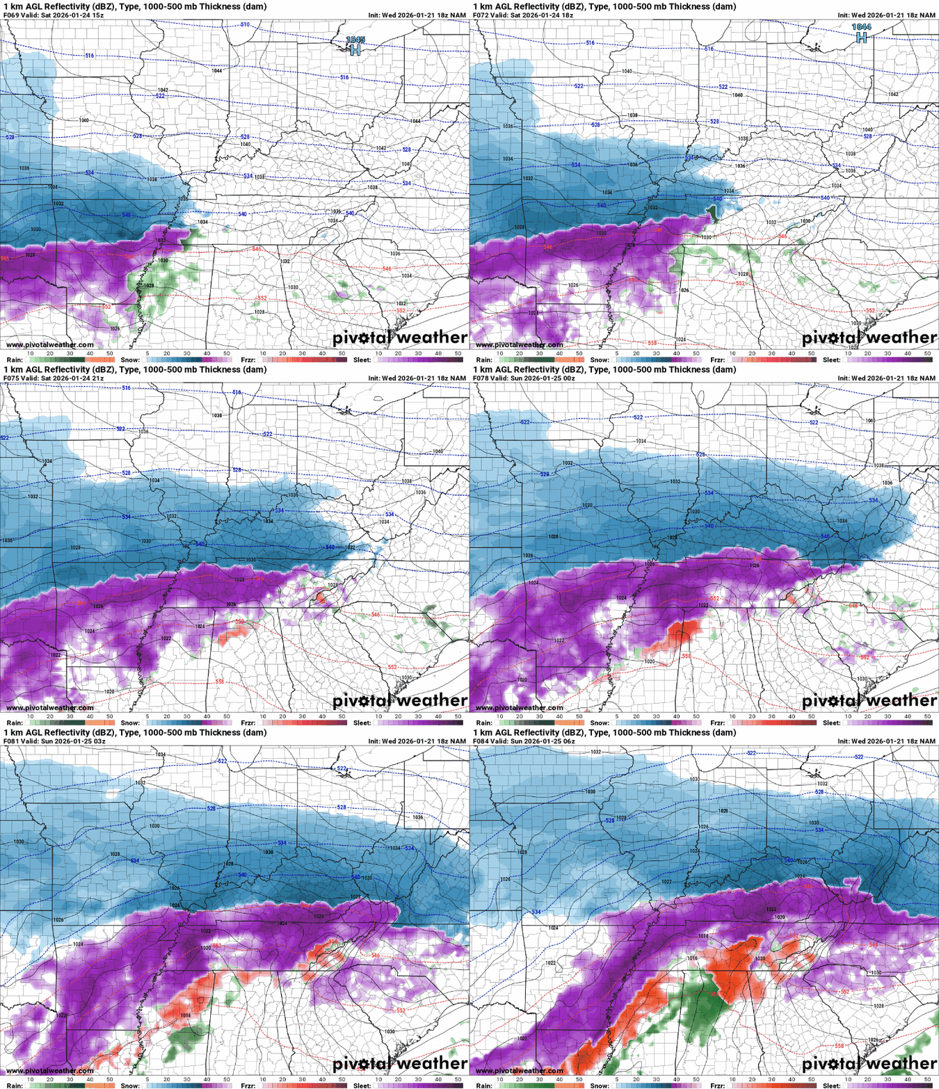
The NAM model adds another wrinkle, suggesting a transition from snow to ice and then back to snow. Once again, if we’re dealing with a high-impact winter storm, the cleaner snow solution shown by the GFS would be the preferred outcome.
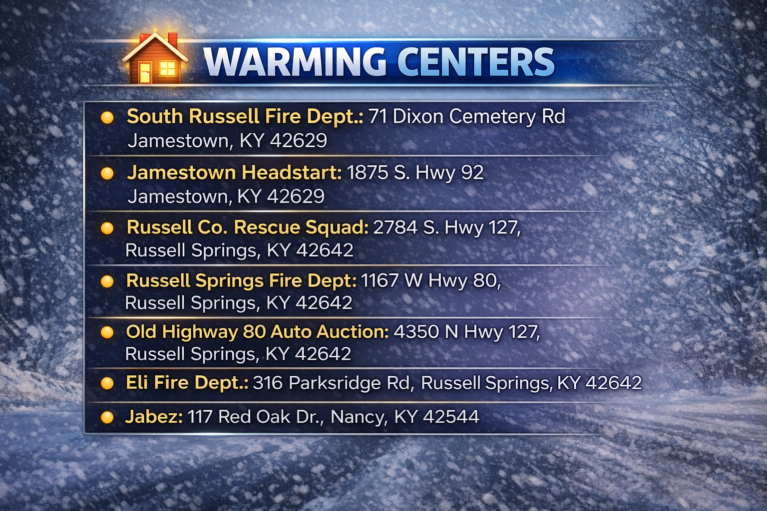
Finally, you’ll find a list of local shelters that will serve as warming centers for anyone without heat. Please check on your neighbors, keep pets indoors, and have supplies on hand in case you need to stay home for an extended period. There’s no need to clear out grocery store shelves, but do make sure you’re prepared just in case.
