
Good Monday, everyone! I first want to say that Mother Nature definitely holds all the cards. We had that system move through Friday which initially did not look to be that big of an impact, but those snow bursts that developed did cause some issues in the area. We received reports of snow-covered roads with numerous reports of cars in ditches around the Lake Cumberland Area. Remember, winter and weather in general are very hard to forecast and Mother Nature does not follow weather models.
We turn our attention to later this week as a significant winter storm could impact much of the Central U.S. with some potential icing here in Kentucky.
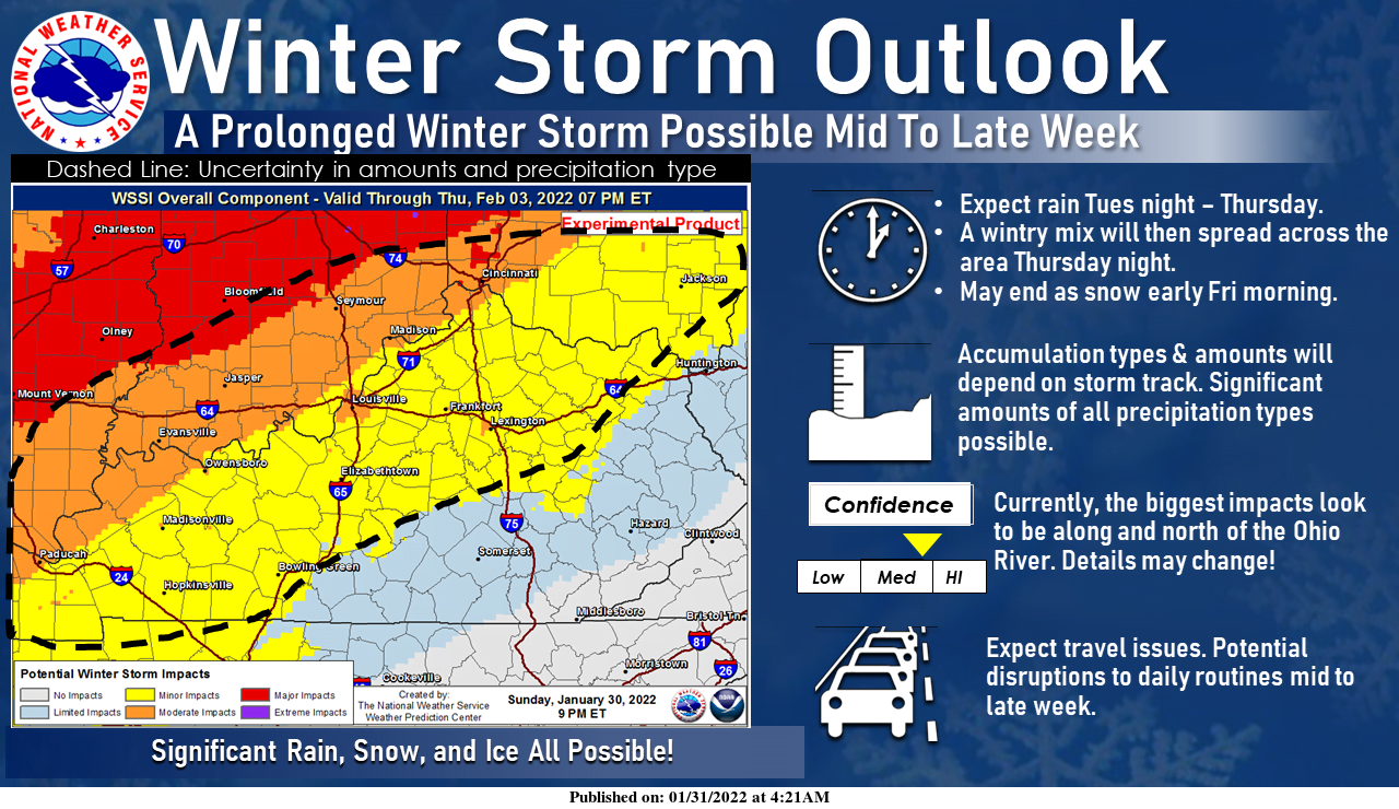
The National Weather Service in Louisville outlined much of Central and Western Kentucky as the best zone for significant issues from this winter storm. Remember, things can and will likely change as we get closer to this event.
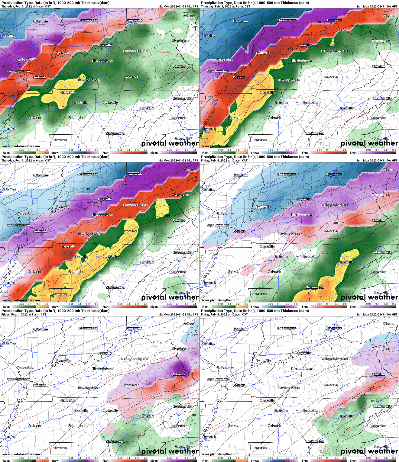
Latest run of the GFS model has a massive shield of rain, mixed precipitation, and snow across Louisville and down the Ohio River and points north. Parts of Illinois and Indiana could receive significant amounts of snowfall. This particular winter storm is very concerning because it looks to be a significant ice event. Ice can cause so many issues from power outages, downed trees, and a solid sheet of ice on roads is extremely dangerous compared to snow. Where does the Lake Cumberland Area stand?
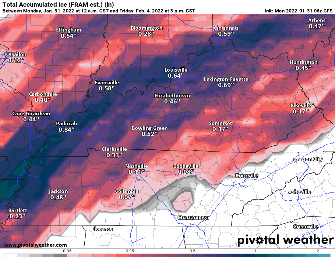
This model shows ice accumulations across the area. Areas to our north and west could very well receive an inch of ice while amounts drop off the farther south you travel. This run has close to a quarter to a half inch of ice for parts of the Lake Cumberland Region. It does not take much ice to cause significant travel and other issues which is why this particular system is very concerning.
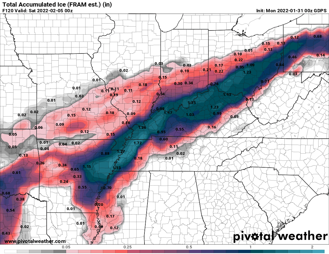
This next model is the potential freezing rain accumulation. There is a huge swatch of up to one-inch amounts of freezing rainfall which will make things extremely dangerous for parts of the state. Amounts range from a quarter of an inch or less in our part of the state.
Models will likely continue to shift amounts as we get closer to the event. This is something I will be watching closely over the next few days.
