
We are keeping a close watch for the potential of strong to severe storms in the area on Wednesday. I will get to that in a moment, but a low end severe weather threat is possible for today.
There’s the latest severe weather outlook today from the Storm Prediction Center. We do have some widely scattered showers out there this morning with some occasional flashes of lightning. We will watch for the development of additional showers and storms later this morning and into the afternoon hours…
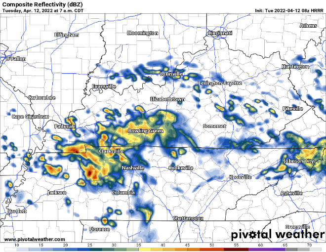
The newest run of the hour-by-hour shows some storms trying to redevelop around lunch time and into the early afternoon hours. This will be where we need to keep an eye out for a few isolated severe storms. Something to watch for this morning is the sun trying to come through the clouds. If we can get some sunshine to help destabilize the atmosphere, that will help fire off some storms later today. I do want to stress that today is a low end severe weather threat and it will be very isolated in nature.
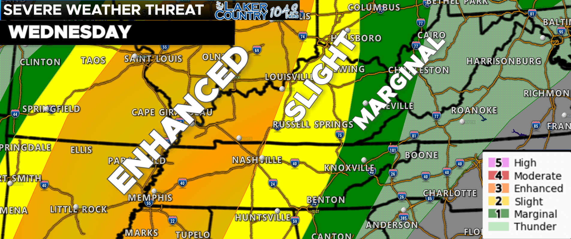
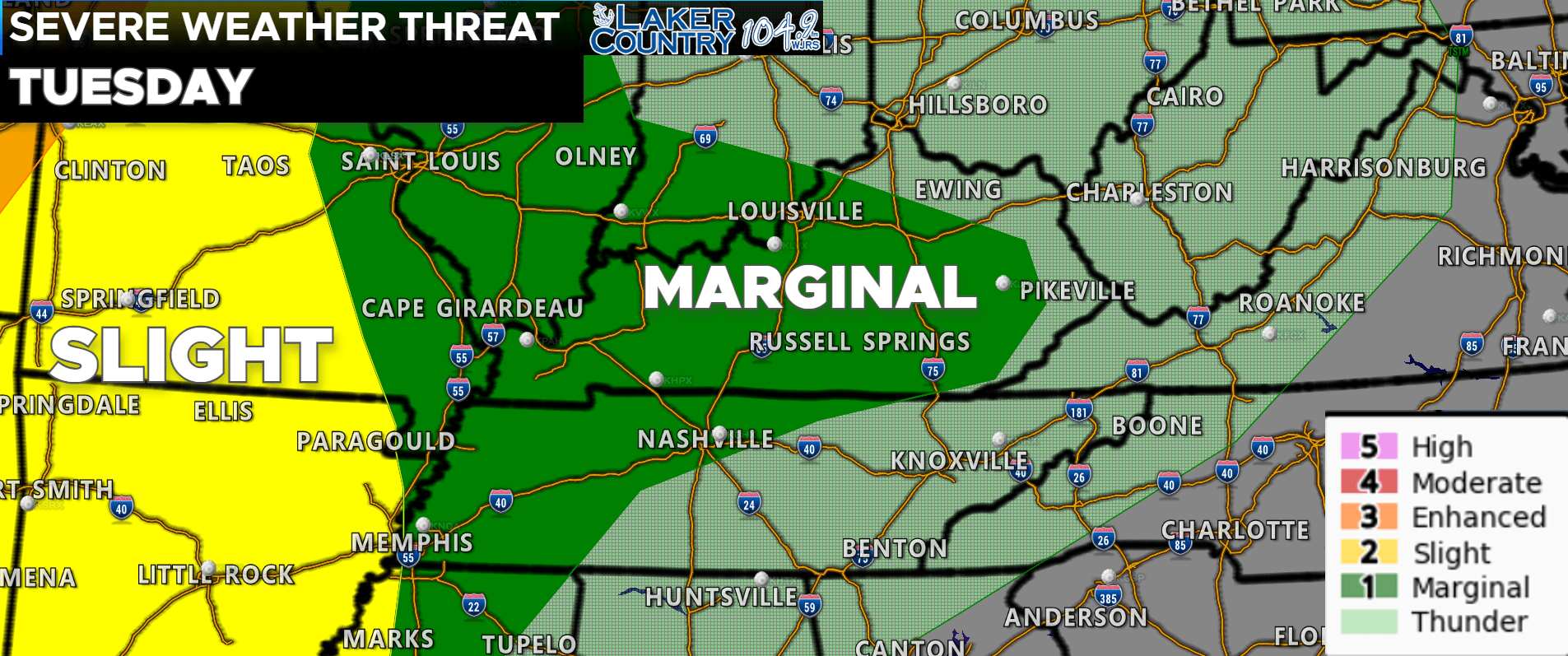
Our attention will focus to tomorrow where we clearly have a better chance at seeing some strong to severe storms. The SPC has three different risk levels across the Commonwealth. The highest is basically from Bowling Green to Louisville and points south and west. This is a level 3 “Enhanced Risk” for severe weather. A level 2 “Slight Risk” is posted for the Lake Cumberland Area. As we move into eastern Kentucky, a level 1 “Marginal Risk” is posted as storms are expected to weaken as they move further east.
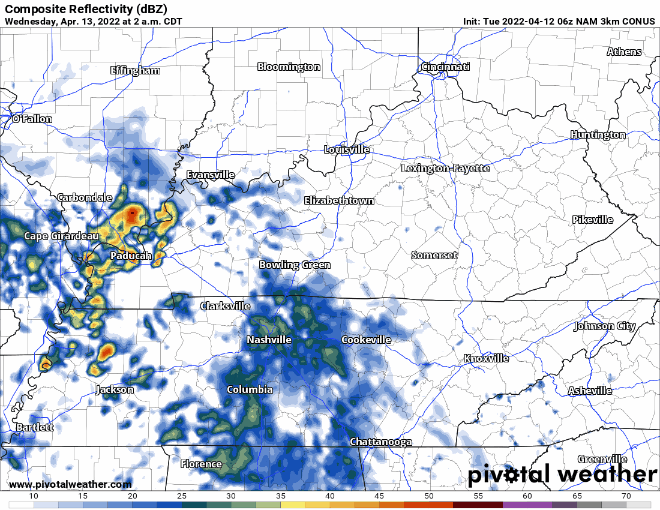
In terms of timing, it looks like some initial showers and storms could develop during the early morning hours of Wednesday. I do not expect these to be severe, but I will keep a close watch. I do expect a pretty quiet afternoon for our part of the world as a line of showers and storms will begin to develop well to our west during the early evening hours. As of this morning, it looks like the best timing for this squall line to move through will be sometime between 11:00 p.m. to 5:00 a.m. I want to stress that this is subject to change. It’s also worth noting that if the morning round slows down and keeps clouds over the area, that could help to lessen the overall severe weather threat.
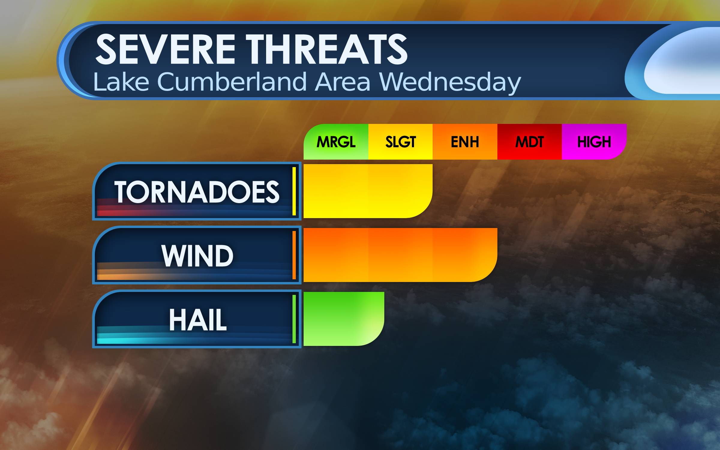
There’s my latest thinking on the potential impacts with tomorrow’s severe weather. This will clearly be a damaging wind concern, but a few isolated tornadoes cannot be ruled out. A conference call with the Louisville National Weather Service is scheduled for this afternoon. This will hopefully provide a more clearer picture on what we could potentially see tomorrow.
It would be a good idea to review your severe weather plan. Make sure you have multiple and reliable ways to receive watches and warnings. I will relay any severe weather information on our social media pages and on the air. You can follow us on Twitter @WJRSRadio and on Facebook at WJRS 104.9 FM Laker Country. If you have a NOAA Weather Radio, make sure to check that it is operational, and please make sure you have your Wireless Emergency Alerts (WEA) notifications enabled on your phone.