
The threat for strong to severe storms will ramp up late this evening and into the nighttime hours. All modes of severe weather are on the table as it appears a squall line will develop to our west and move through the region late tonight.
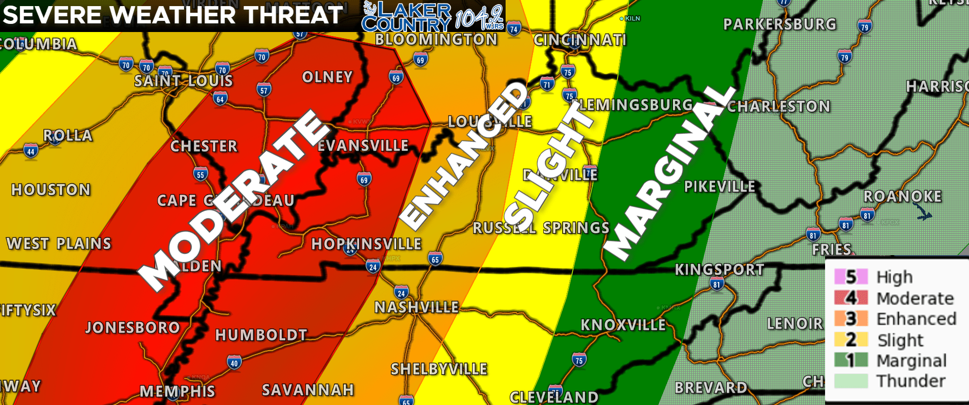
This is the latest severe weather outlook from the Storm Prediction Center. The Lake Cumberland Area is in the level 2 Slight Risk. A level 3 Enhanced Risk is posted just to the west of our area, and then a level 4 Moderate Risk is out for Western Kentucky. I do expect some showers and maybe some thunderstorms to move through later on this morning and into the very early afternoon hours. The timing of this will be key in figuring out how bad severe weather could be tonight. If showers move through rather quickly, and the sun can come out, and stay out for several hours this afternoon, that will in turn enhance the severe weather threat. If we are able to keep clouds over the area when those showers move through and keep the atmosphere from heating up, the severe weather threat will lessen.
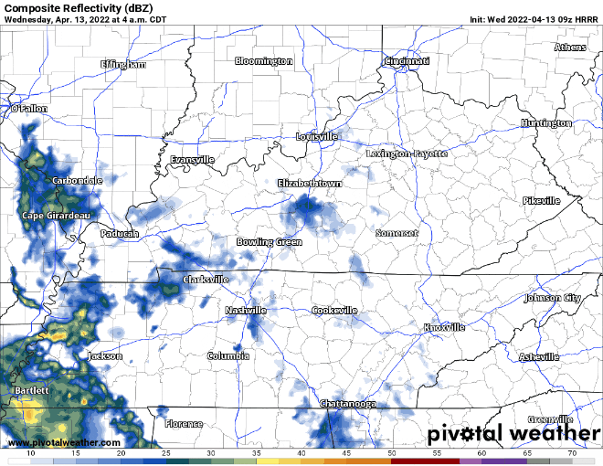
There’s a look at the latest hour-by-hour. Don’t take this to the bank as this is just a model and we know things can change quickly. This run has showers and maybe a few storms moving through late this morning. No severe weather is expected with the early round of showers and storms.
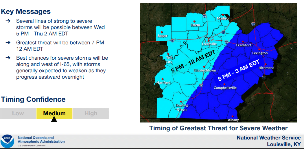
This is from the National Weather Service Office in Louisville. The timing of this is going to be tricky as we just don’t know how fast that squall line develops and begins to march toward our area. This graphic has the timing for the best chance of severe weather in our area from 8:00 p.m. to 3:00 a.m. This could change though so make sure you stay weather aware throughout the day.
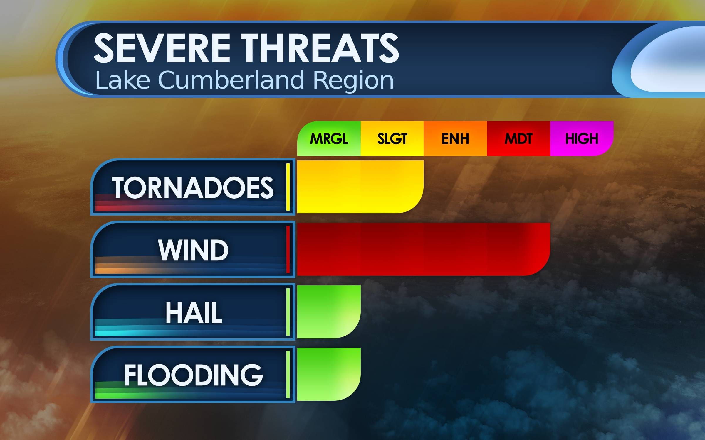
The greatest severe weather threat, including a few strong tornadoes is across the western portion of Kentucky. I think the best threat for our area is damaging straight line winds. I cannot rule out an isolated tornado or two for the region. Make sure you have multiple and reliable ways to receive watch and warning information. I will push updates out on our social media platforms and on the air. I recommend you have a NOAA Weather Radio to alert you should a watch or warning be issued for your area. Please make sure you have your Wireless Emergency Alerts (WEA) notifications enabled on your phone.