
The first three days of the week look be active as severe weather will be possible each day. Let’s get started with the severe weather threat for today…
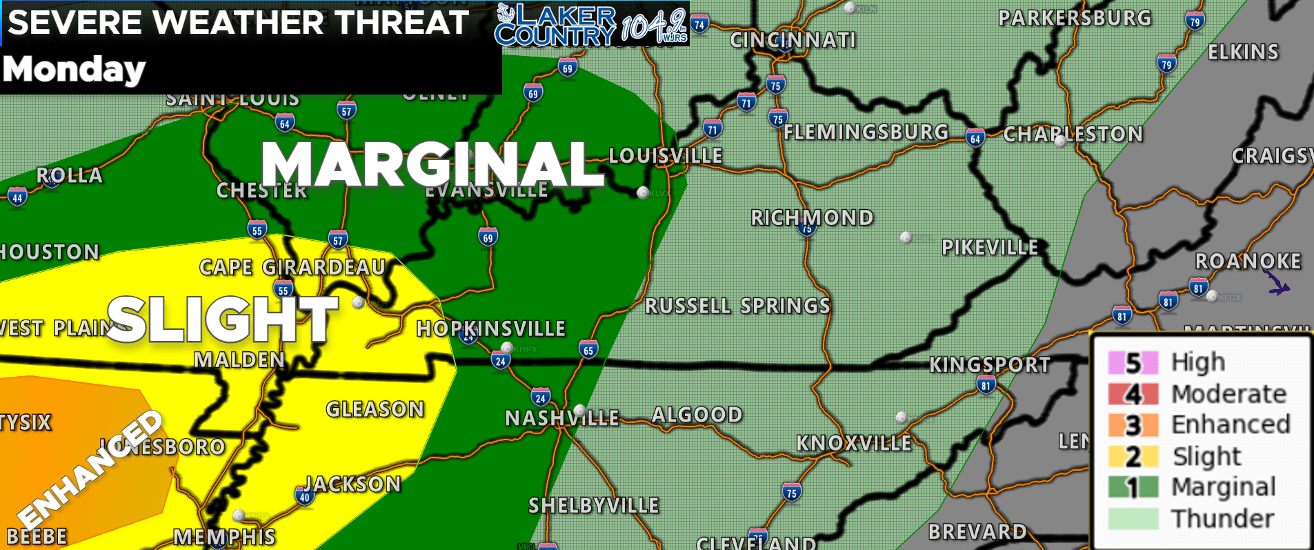
The Storm Prediction Center has a level 1 threat posted to our west around Bowling Green. A level 2 and level 3 risk are further west. As of right now, the Lake Cumberland Area is not in a threat for severe weather. However, storms will be possible throughout the day, and a few could become strong. Here’s the latest hour-by-hour…
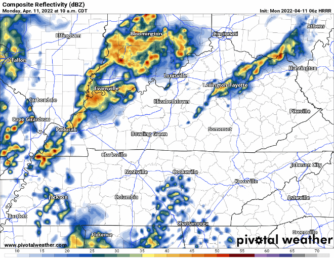
You can see storms will begin to form to the west by late morning and into the early afternoon hours. An initial round will come through our area sometime between 2:00 to 6:00 p.m. this afternoon. Worth noting that another round of storms looks to move through the late overnight and very early morning hours into Tuesday.
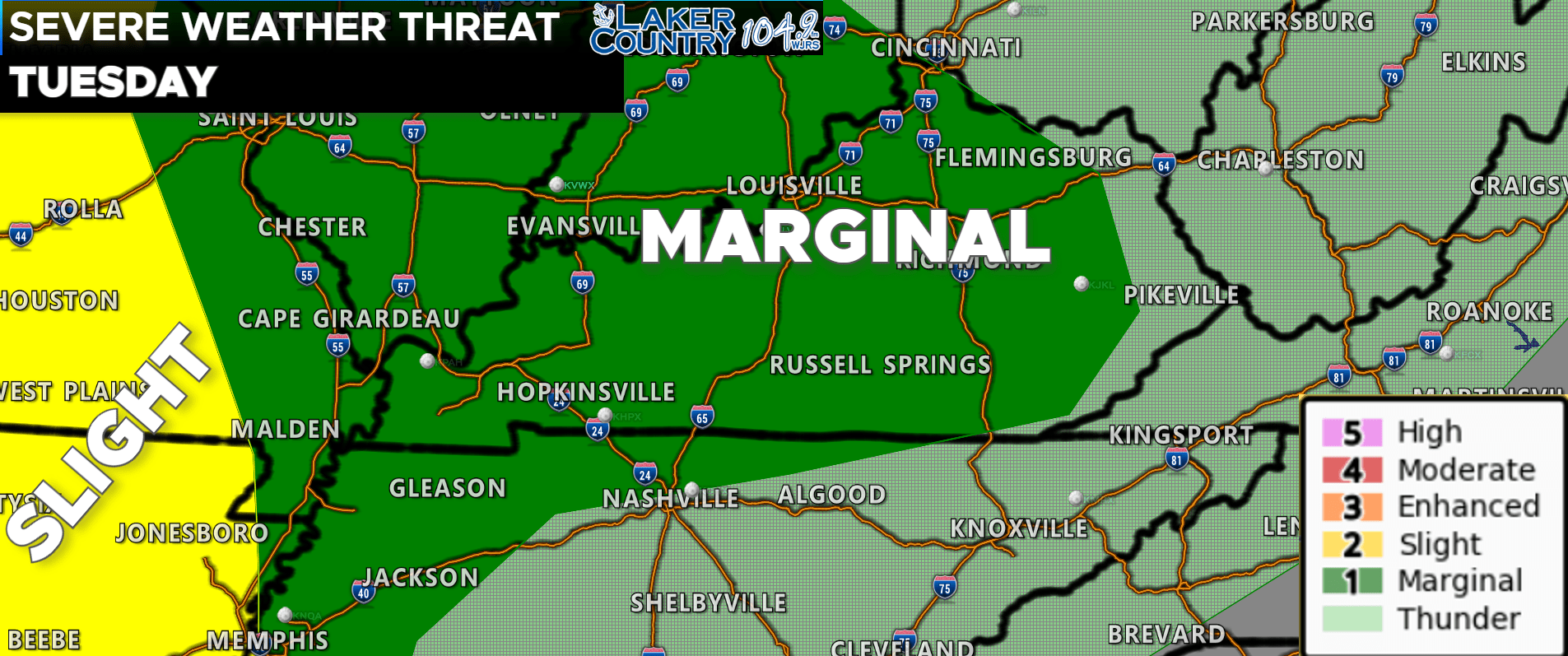
The severe weather threat shifts further to the east tomorrow. Currently, the Lake Cumberland Area is in a level 1 risk for severe weather. A level 2 risk is posted across parts of Missouri and Arkansas. We will keep a close watch on that batch of storms that looks to move through the early morning hours of Tuesday. We should see a break Tuesday before another chance of strong to severe storms. The afternoon round looks to be more isolated in nature. I will be watching the morning round Tuesday for the best severe weather threat.
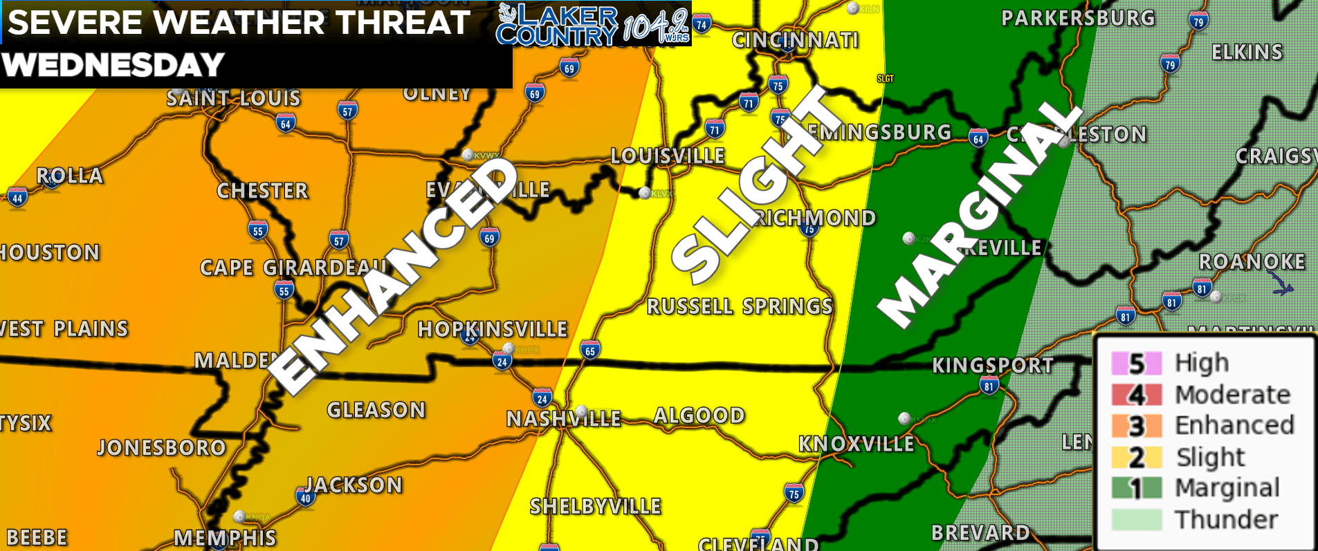
Wednesday is clearly the day I am watching very closely for severe weather. The Storm Prediction Center already has a level 3 risk posted. The Lake Cumberland Area is currently in a level 2 risk. A level 1 risk is posted to the east where storms may not be as intense. As I said a level 3 risk is already out and this includes areas around Bowling Green and points west. Wednesday will be the day to make sure you are weather aware. Right now, is a good time to review your severe weather plan. I want to stress that it is very important to have multiple and reliable ways to receive watches and warnings. I will have any watches and warnings posted to our social media pages and on the air. This is a good time to have a NOAA Weather Radio and PLEASE make sure you have Wireless Emergency Alerts (WEA) notifications enabled on your phone.
I will provide more information on timing and threats for Wednesday as we get closer to the event. All modes of severe weather are on the table though. Stay tuned on here, our social media pages, and on Laker Country 104.9 for more information.