
Good morning, everyone. We are now midway through the work week with a possible winter storm moving in tomorrow and into the morning hours on Friday. The National Weather Service in Louisville has been busy issuing watches, warnings, and advisories.
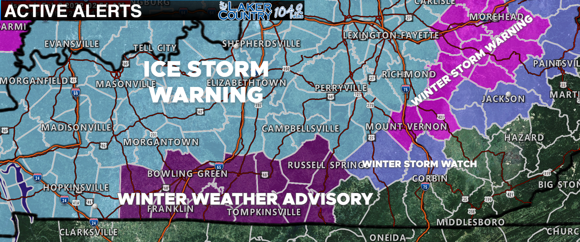
The map above is the winter related alerts issued for the area. Russell, Adair, Clinton, Cumberland, and Metcalfe Counties are all under a Winter Weather Advisory. Casey, Green and Taylor Counties are all under an Ice Storm Warning. Pulaski County is currently under a Winter Storm Watch. All of these Watches, Warnings, and Advisories will go into effect tomorrow morning.
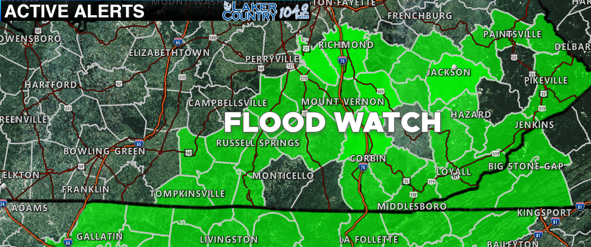
The counties shaded in green are under a Flood Watch that will go into effect tomorrow morning. Russell, Adair, Casey, Clinton, Cumberland, Pulaski, and Metcalfe Counties are all included.
Models have gone back and forth on the ice storm potential for late tomorrow night and early Friday morning. Right now, it appears the best chance for significant ice accumulations are going to be to our north.
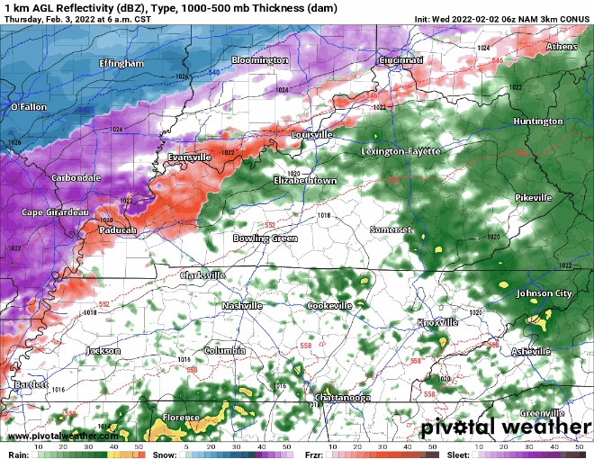
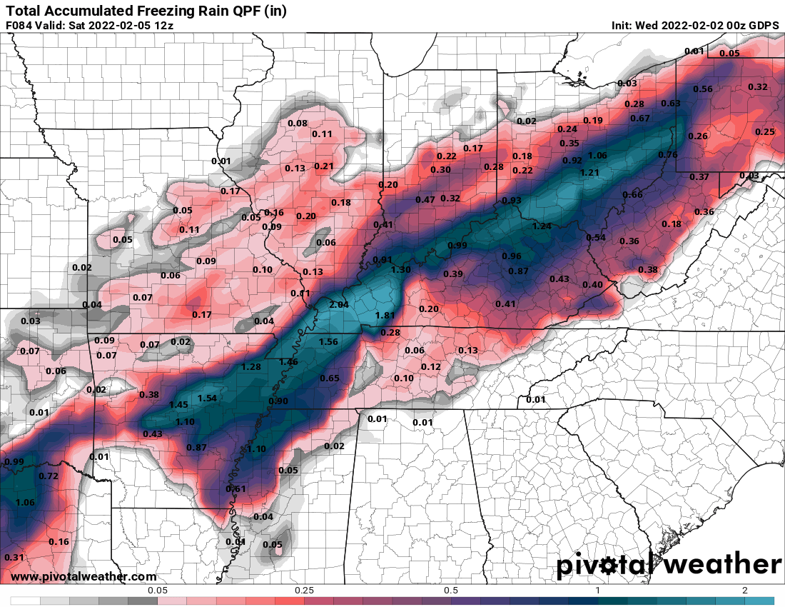
The map above is the latest high-resolution NAM model. A shield of rain will hang out across the southern part of the state that could lead to flooding in some areas. You can see the mixed precipitation is concentrated to our north, but a changeover will occur at some point late Thursday and early Friday,
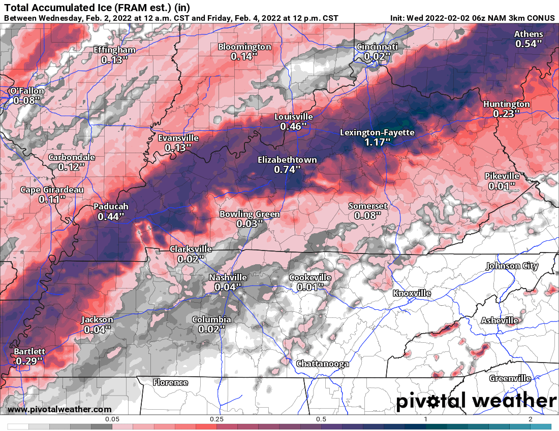
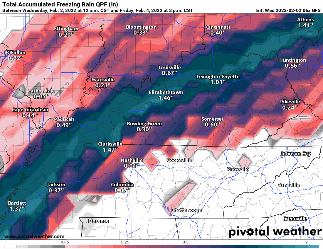
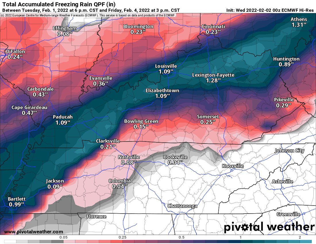
With the exception of the GFS model, most of the other models are showing around a tenth of an inch of ice possible here in Russell County. Remember, it does not take much ice to cause major issues so don’t get a false sense of security. The GFS is trying to place close to a half inch of ice in the region. Certainly, something I will continue to watch very closely as we move through the day. As it stands right now, the best potential for significant ice is to our north and west.
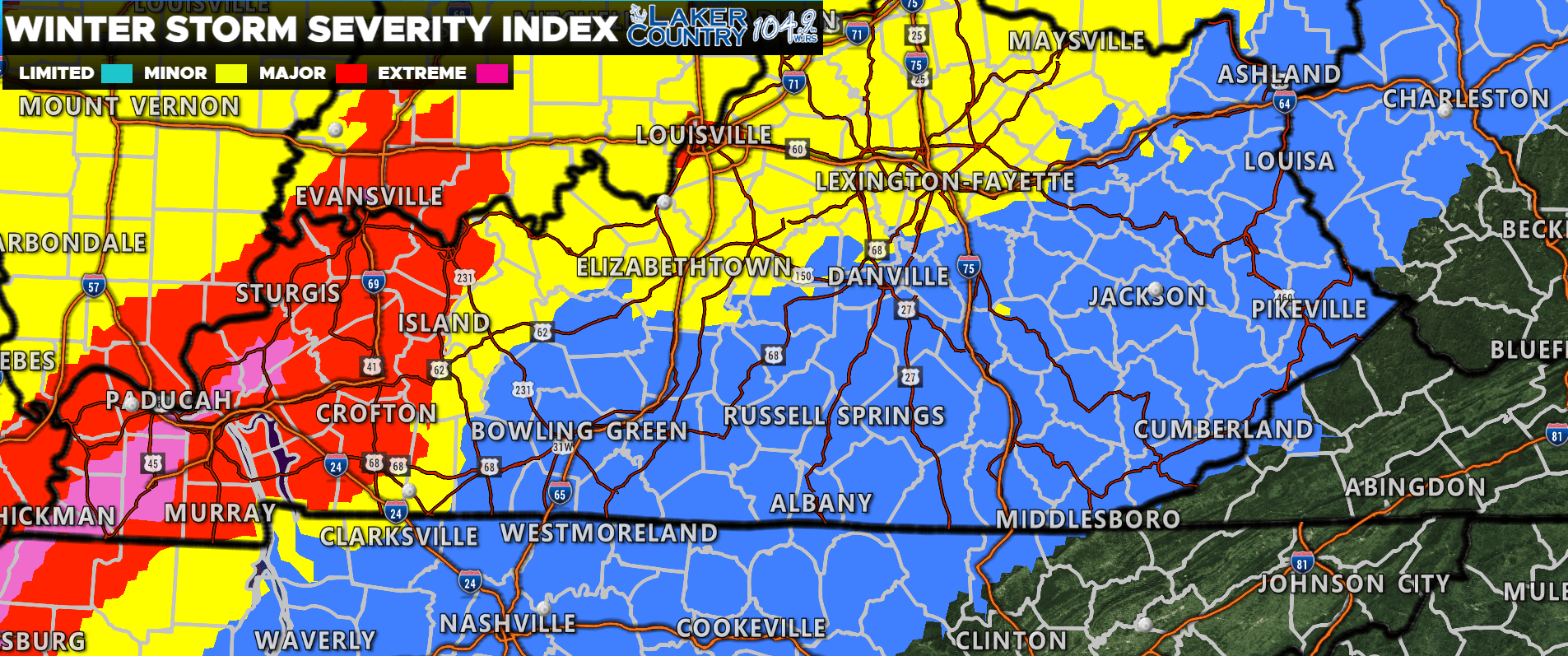
This map above is called the Winter Storm Severity Index and is a product of the Weather Prediction Center. You can see our area is in that blue “Limited” section while the higher levels remain to our north and west. Some adjustments may be made to this as we get closer to the event, but this kind of gives you an idea on where the experts believe the higher impacts will be located at. Slight variation in the track of this system could result in large differences in the weather we experience.
I will continue to watch model trends as we move throughout the day today with updates posts as needed.