
Good Thursday, everyone! Our system that came through the region yesterday proved to be a rainmaker as the dynamics for severe weather were just not supported for the region. We are now going to look ahead to the severe weather threat that begins late tomorrow night and into early Saturday.
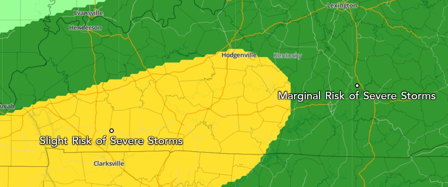
This is a look at the SPC severe weather outlook for our day tomorrow. Much of South-Central Kentucky is in a level 2 slight risk. Russell County and points east is right on the fringe of that Slight and Marginal severe weather threat. I always like to stress that you do not need to get caught up in the colors. Just because Adair County is in the level 2 risk and Russell is right on the fringe does not necessarily mean storms will be worse in Adair.
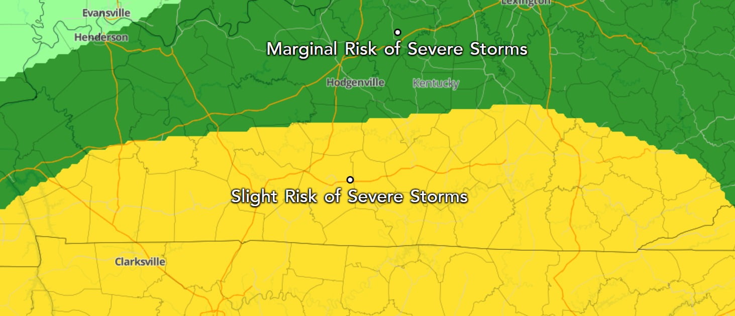
This next outlook is for the day on Saturday. This does have Russell County and pretty much all of Southern Kentucky in the level 2 Slight Risk. This means we can expect multiple waves of showers and thunderstorms that could become severe. The biggest concern right now though is flooding rainfall.
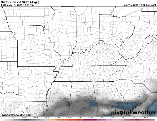
One thing I have talked a lot about in looking at these severe weather setups is do we have the ingredients to support severe weather. This is still a big question for me at the time of writing this post. The map above shows the CAPE, or Convective Available Potential Energy. This is one of the many factors considered in forecasting a severe weather event. The latest run of this model definitely shows the presence of some CAPE but nothing off the charts. You don’t need a crazy amount of CAPE for severe weather to occur though.
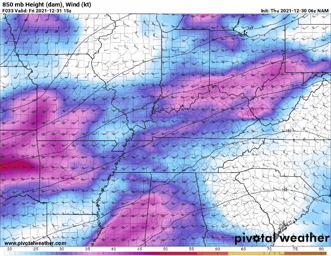
Something else that is considered in forecasting severe weather is the winds in the upper atmosphere. This is a look at the upper-level winds, and you can see some of those brighter colors associated with the lower-level jet moving into the state on Saturday.
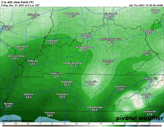
As we go through Friday and into Saturday, you can see a surge of moisture coming in from the Gulf of Mexico. Those dewpoints start in the 50s, but that surge will quickly bring dewpoints into the lower 60s which is certainly enough moisture in the air for the development of showers and thunderstorms.
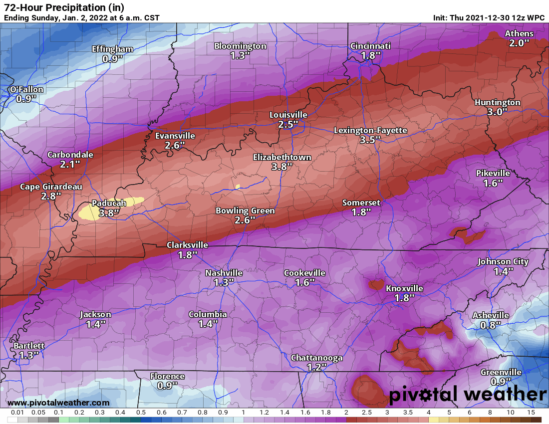
The map you are now looking at is projected rainfall totals for this weekend from The Weather Prediction Center. I mentioned earlier that flooding rainfall was the more concerning threat with this system. This latest projection shows rainfall amounts of 1-3 inches for much of the Commonwealth, including Russell County. I would not be at all surprised, barring a significant change, if the National Weather Service in Louisville does not issue some sort of Flood Watch for parts of Kentucky. I will update this post if that watch does get issued.
My thoughts:
This is sort of a complicated forecast when it comes to figuring out the threat for strong to severe storms. I want to stress that flooding rainfall is the biggest concern. Remember, if you live in a flood prone area, you need to please be mindful of rising waters and if you come across a road with standing water to Turn Around, Don’t Drown. I do think there is a threat for a few severe storms on Friday night and Saturday. The main threats will be damaging winds with a chance of an isolated tornado or two. I will continue to come back this post with updates as they come in.
Looking ahead:
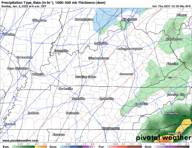
This is the latest run of the GFS model. What is that blue stuff on the map? That is snow showers that could into the area later in the day on Sunday behind this system. I don’t expect anything major, but don’t be surprised if you see a few snowflakes flying around.