
Happy Wednesday, everyone! A strong storm system will drop into the area later tonight and that will set the stage for the potential of strong to severe thunderstorms. Let’s first talk about what we can expect throughout the day today.
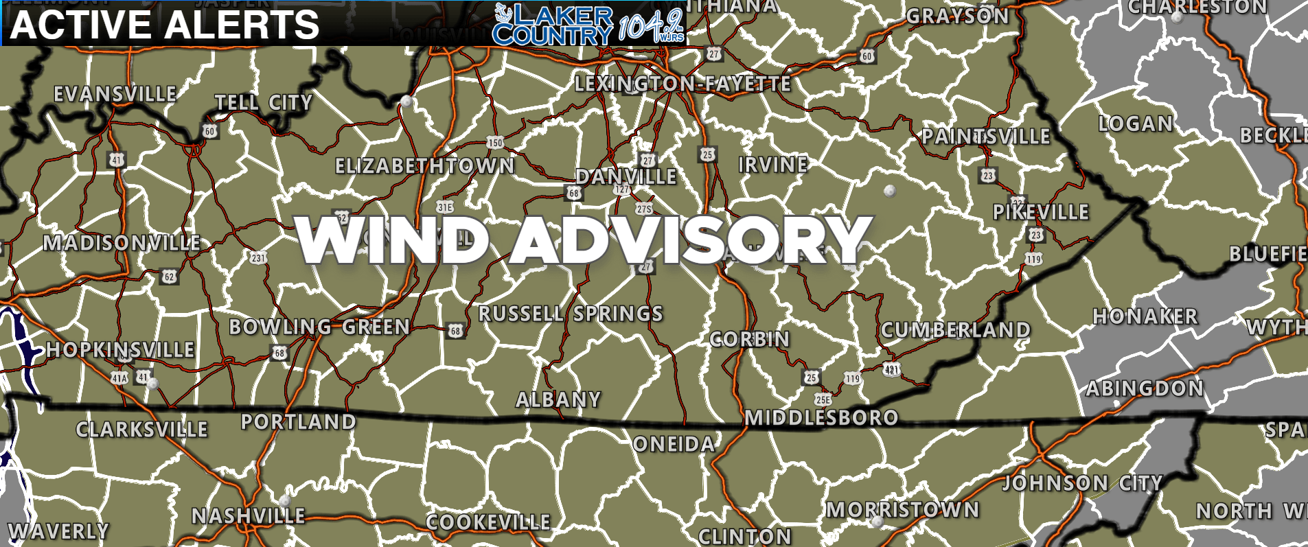
It will be a very nice spring day with sunshine and temperatures in the lower 80’s. Winds could be very gusty at times throughout the day. The National Weather Service in Louisville has a Wind Advisory out for the entire Lake Cumberland Region.
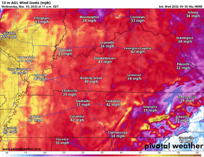
Check out those possible wind gusts this afternoon. Some folks could see gusts as high as 50-55mph. This would be a good time to tie up any loose furniture or outdoor items you have in your yard.
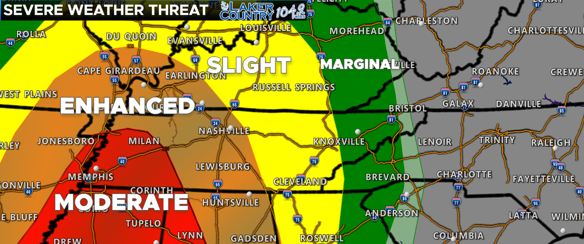
There’s the latest Severe Thunderstorm Outlook from the Storm Prediction Center. A level 2 Slight Risk is out for all of the Lake Cumberland Area. In Western Kentucky from Hopkinsville to Paducah, a Level 3 Enhanced Risk is out for that area. We do note that a level 4 Moderate Risk is just to our south and west in parts of Tennessee. I think the best chance for severe weather is across Western Kentucky and points south.
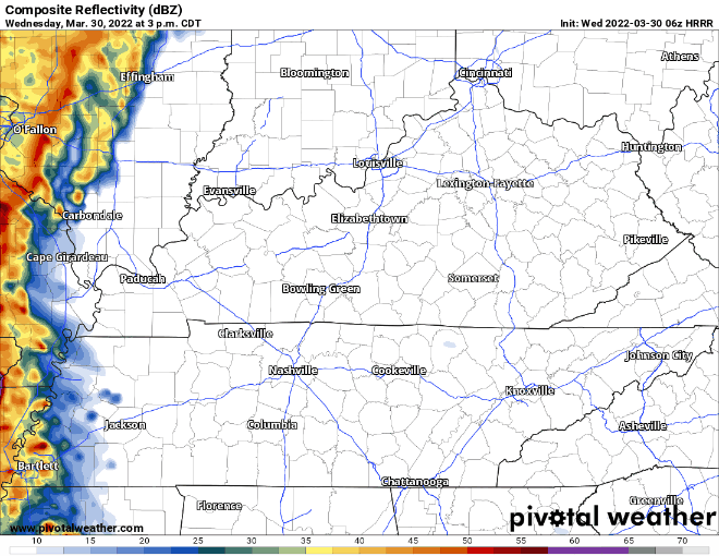
Latest hour-by-hour radar has that line of showers and storms moving across the region this evening. I think the best timeframe is anywhere from 7:00 p.m. to 11:00 p.m. tonight.
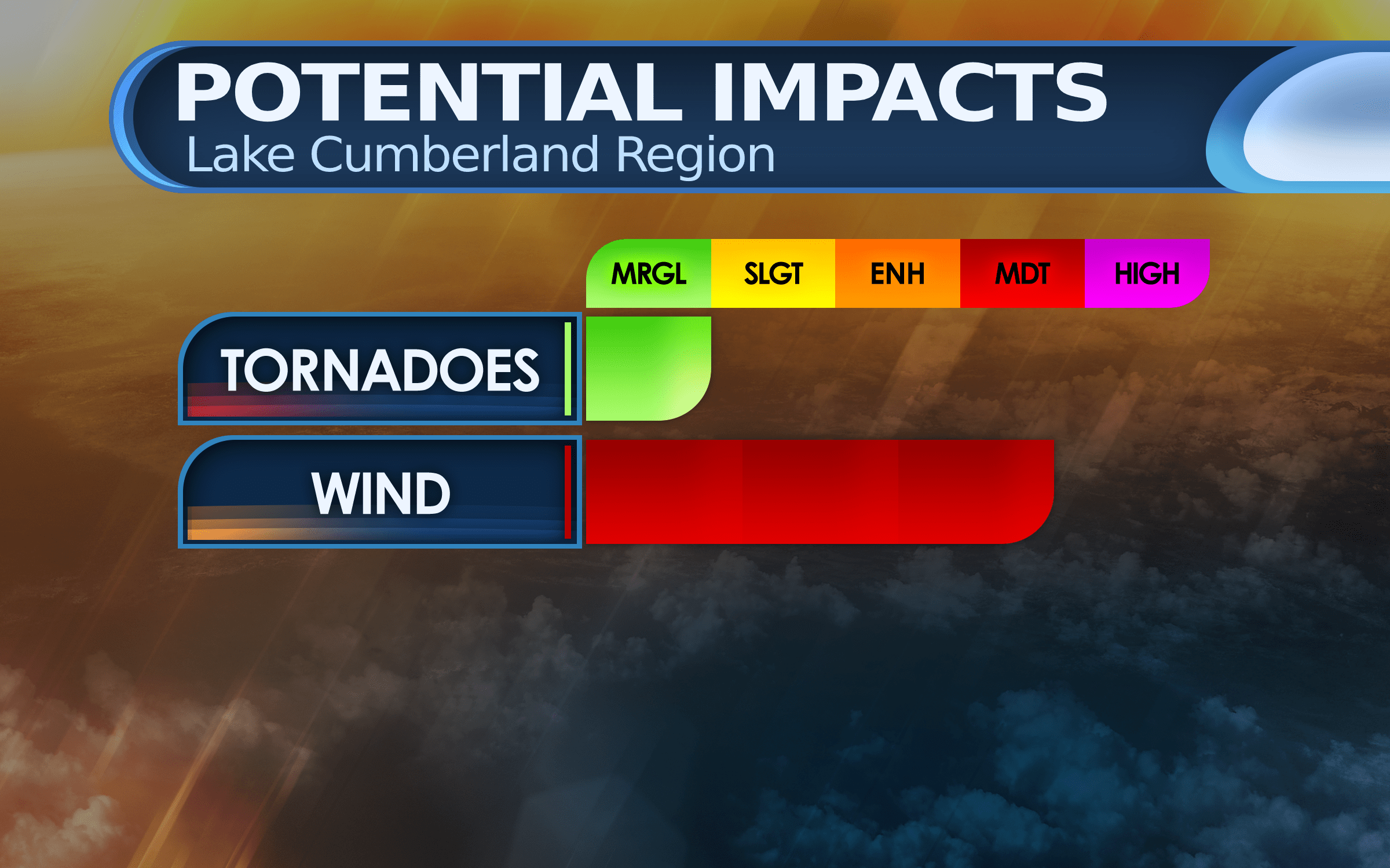
There’s my latest thinking on the potential impacts with the storms for tonight. I think the tornado threat is pretty low, but not zero. The biggest threat is certainly very gusty winds. We could see some potential wind damage even without thunderstorms. I will keep a close watch on everything today and post updates as they are available. Stay tuned to Laker Country 104.9 for more information.