
Good morning and Happy Valentine’s Day! Temperatures are starting out in the lower 20’s this morning so make sure you have a jacket as you head out. High’s will be in the 40’s today and then rebound to near 60 tomorrow with mid 60’s on Wednesday.
A storm system will make its way into the area for Thursday and that is something we are going to have to keep an eye on.
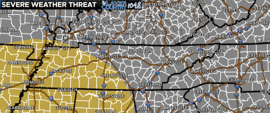
The Storm Prediction Center has outlined a severe weather threat to our west and south for the day on Thursday. It does appear for now the best chance for organized severe weather will remain south of our part of the world.
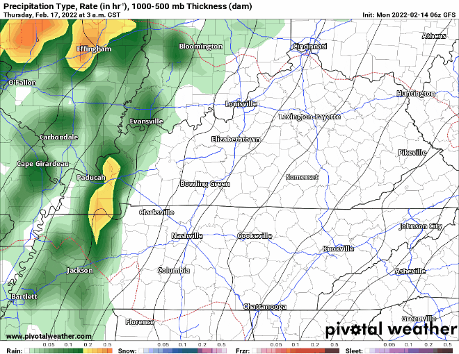
Latest run of the GFS has a line of showers and embedded thunderstorms moving through early Thursday morning and then a possible second round coming through late Thursday afternoon and evening. Let’s look at one of the parameters used in forecasting severe weather…
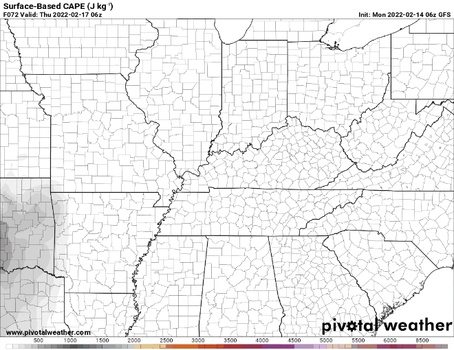
This is the forecasted CAPE values for Thursday. CAPE stands for Convective Available Potential Energy. Think of this as the fuel for storms to feed off of. The grey on the map represents where CAPE is forecast to be. The higher amounts continue to show up in the southern states where SPC has outlined that threat for severe weather.
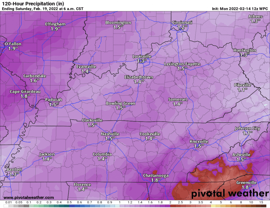
Projected rainfall amounts for this week are anywhere from an inch to a half inch for some. I will continue to keep a close watch for any changes in the forecast, and post updates as more information becomes available.