
Good morning, everyone and happy Thursday! The focus today is going to be on this potential winter/ice storm impacting parts of Kentucky. The best chance for significant ice does remain to our north and west as of this morning.
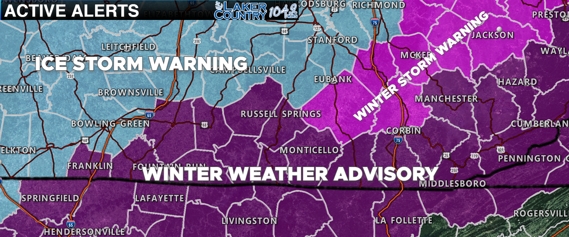
Not much has changed with the winter related alerts. Russell, Adair, Clinton, Cumberland, Metcalfe, and Wayne Counties are all under a Winter Weather Advisory. Casey, Green, and Taylor Counties are all under an Ice Storm Warning. Pulaski and other counties to our east remain under a Winter Storm Warning.
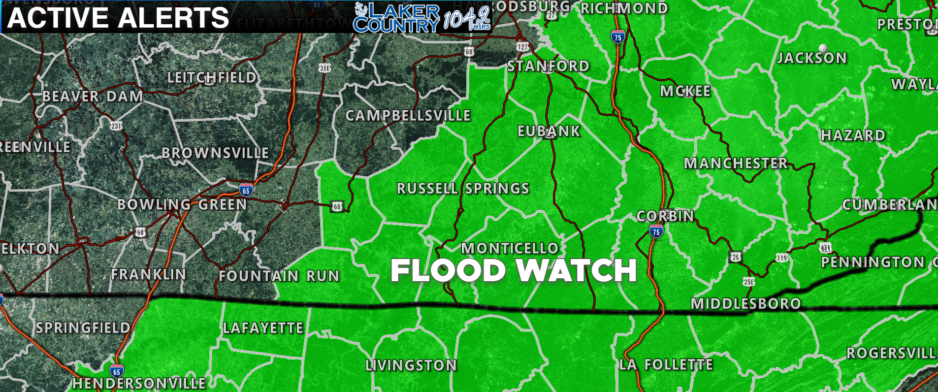
The Weather Service in Louisville has also issued a Flood Watch for Russell, Casey, Adair, Metcalfe, Clinton, and Cumberland counties. The big talk has been the potential icing that could occur later on tonight, but some areas could have flooding issues due to all the rainfall we will experience throughout today.
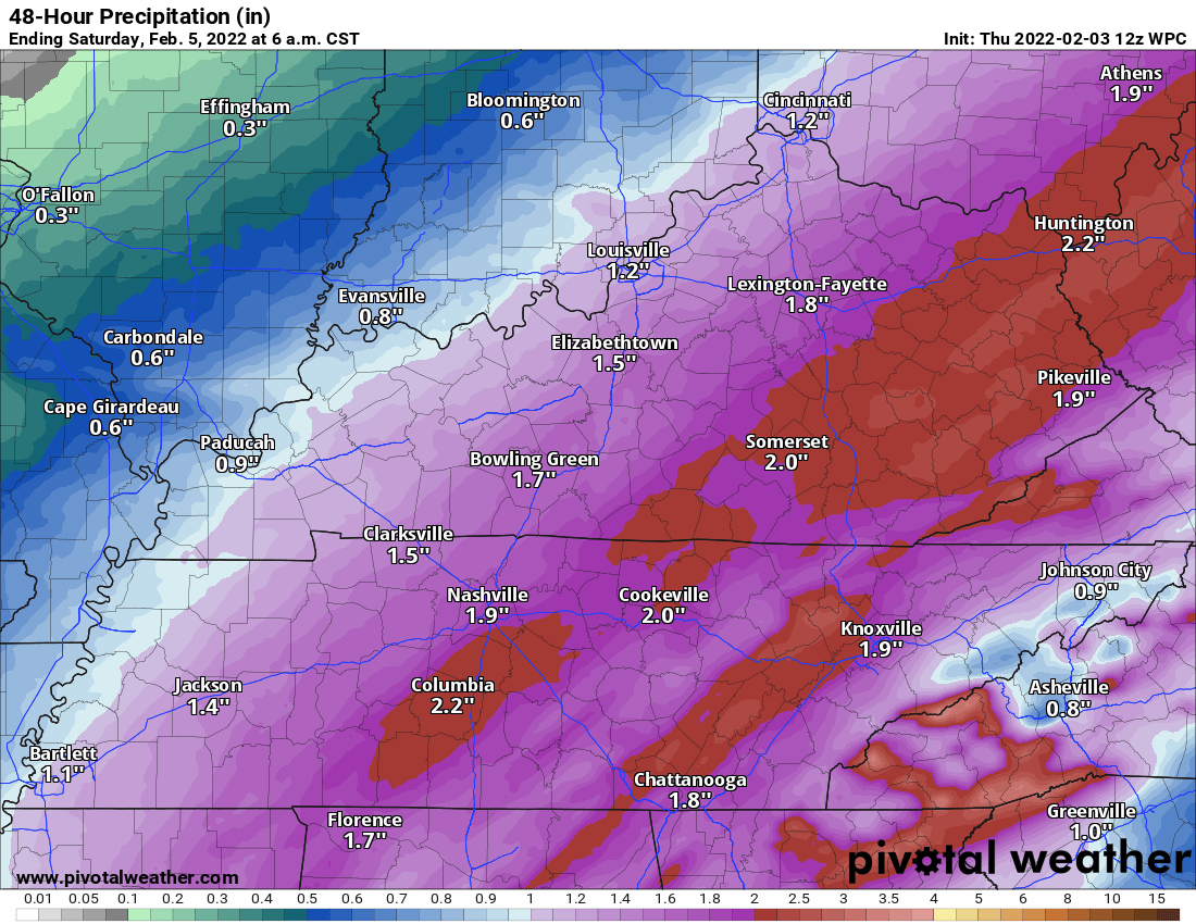
This is the latest rainfall projections over the next 48 hours. You can see some folks here in the Lake Cumberland Area may see two inches of rain with some locally higher amounts possible. If you live in a low-lying area, make sure you keep a close watch for any potential flooding later today.
The big talk around Kentucky has been this major ice storm that will impact parts of the state today and into the overnight hours. The best threat for significant ice remains to our north and west where some folks could receive close to an inch or more of ice.
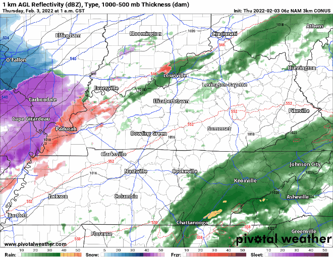
There’s the latest high-resolution NAM model. You can see a huge swath of rain laying on top of Southern Kentucky and the Lake Cumberland Area, while the mixed precipitation is focused from the Ohio River to Lexington and Central Kentucky. Let’s get a rundown of the what the various models are thinking in terms of ice accumulation…
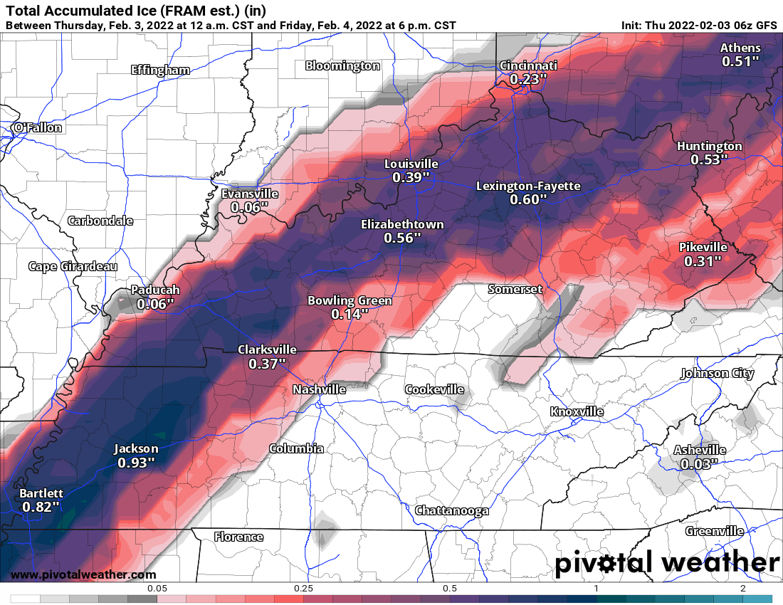
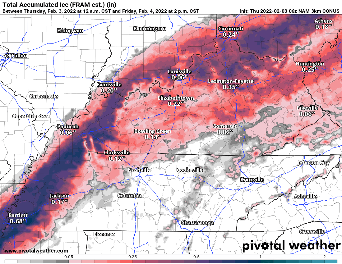
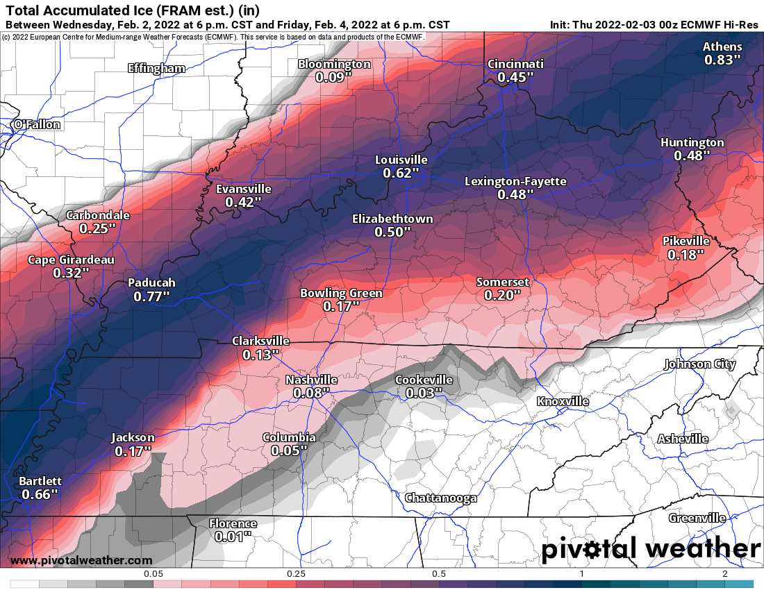
All models are pointing toward significant icing focused from Lexington and Louisville and down into Western Kentucky. Ice amounts remain around a tenth to a quarter of an inch for Russell and surrounding counties. I do want to remind you that any slight change in the track of this system could alter the impacts for different areas, so don’t get a false sense of security. While the significant ice looks to remain north, it will not take much in the way of ice accumulation to cause travel issues. It looks like the timing for the switch from rain to freezing rain and sleet will occur sometime late tonight in our part of the world.
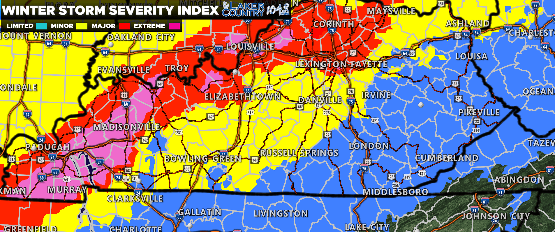
Here’s the latest Winter Storm Severity Index from the Weather Prediction Center. Russell, Casey, Adair, Green, and Taylor County are all in that yellow “minor” category while the higher threats are to our north and west. Remember, it will not take much ice to cause travel issues, so we do not advise travel especially late tonight and early Friday morning. I will be watching for any changes in the forecast amounts and will post updates as needed.