
Good morning, everyone. Our focus continues to be on a possible winter/ice storm that could impact the region toward the end of this week. Let’s start off with today as temperatures will climb to near 60 degrees with a mostly sunny sky. Shower chances will begin to increase late tonight and those chances will only increase as we move through the remainder of the work week.
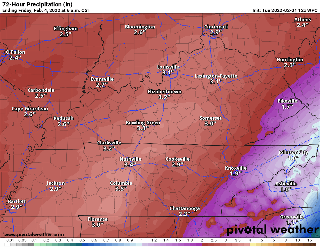
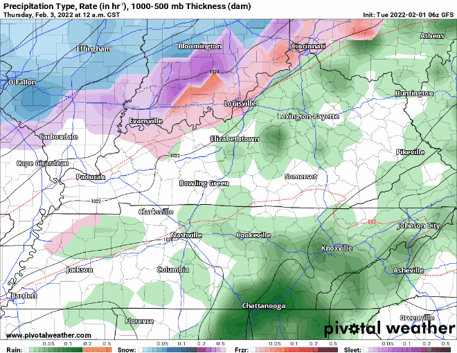
This graphic is from the Weather Prediction Center and projects possible rain amounts from now to the end of this week. You can see some folks could get up to three inches of rainfall in some areas. I would not be at all surprised if a Flash Flood Watch is issued at some point. Our attention will shift for a possible icing event for late Thursday night and the early morning hours on Friday.
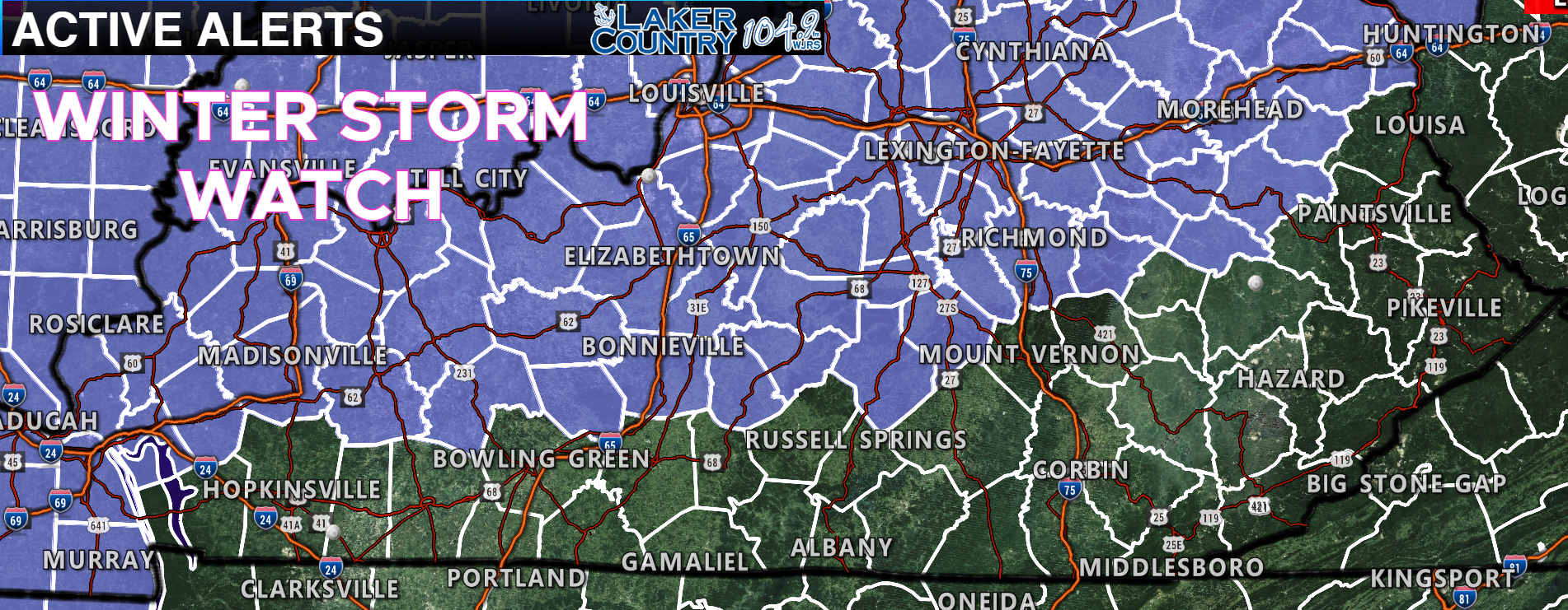
The National Weather Service has issued a Winter Storm Watch for the counties shaded in the above map. This watch will go into effect for the day on Thursday and as of this moment does not include Russell County. The watch does include Casey, Green, and Taylor Counties.
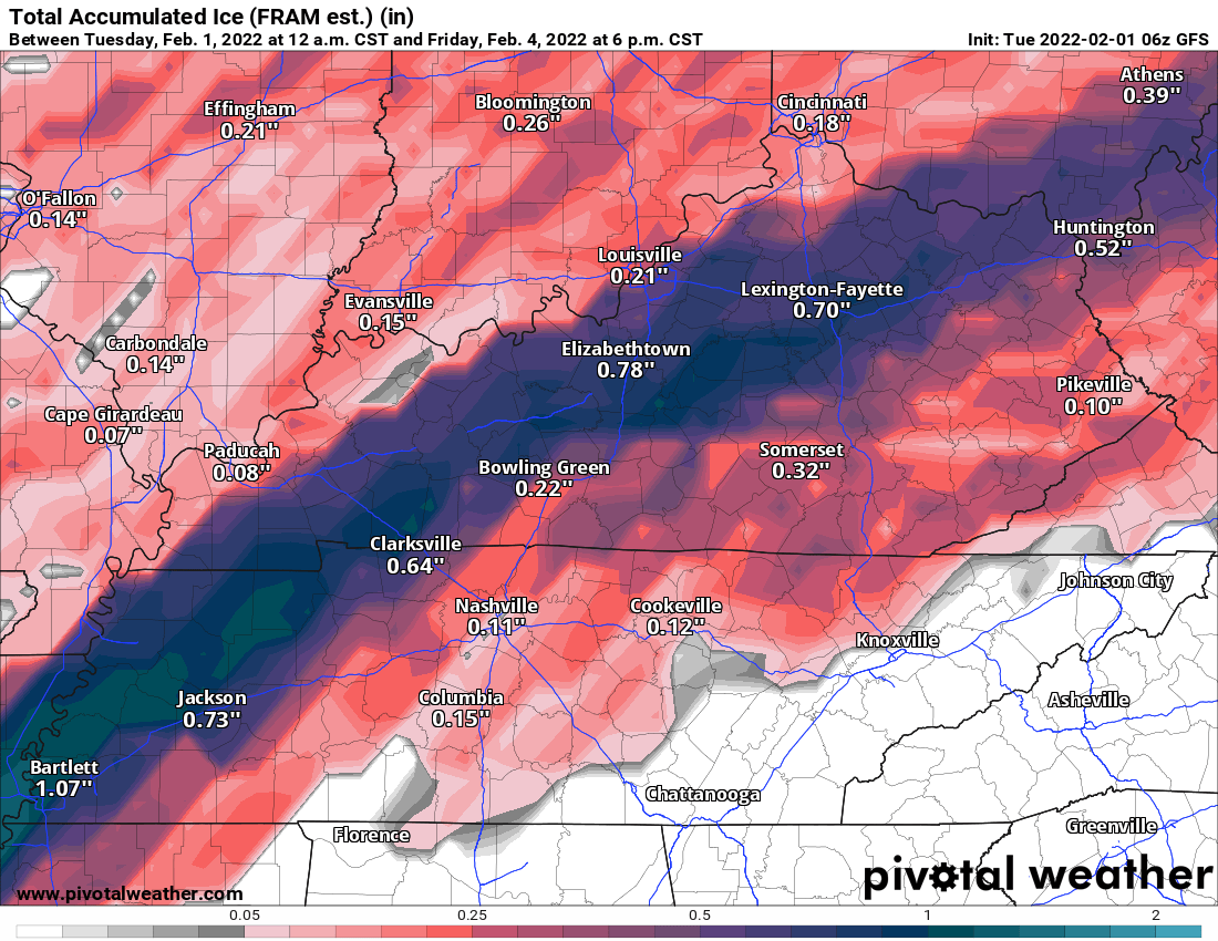
The two maps above are the newest run of the GFS model. The concern for major icing continues to be from around the Ashland area and going in a diagonal line through Lexington, Elizabethtown, and into Western Kentucky. This run has most of the Lake Cumberland Area around a quarter inch of ice which is more than sufficient to cause major travel and other issues.
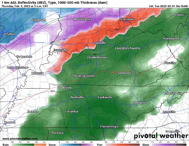
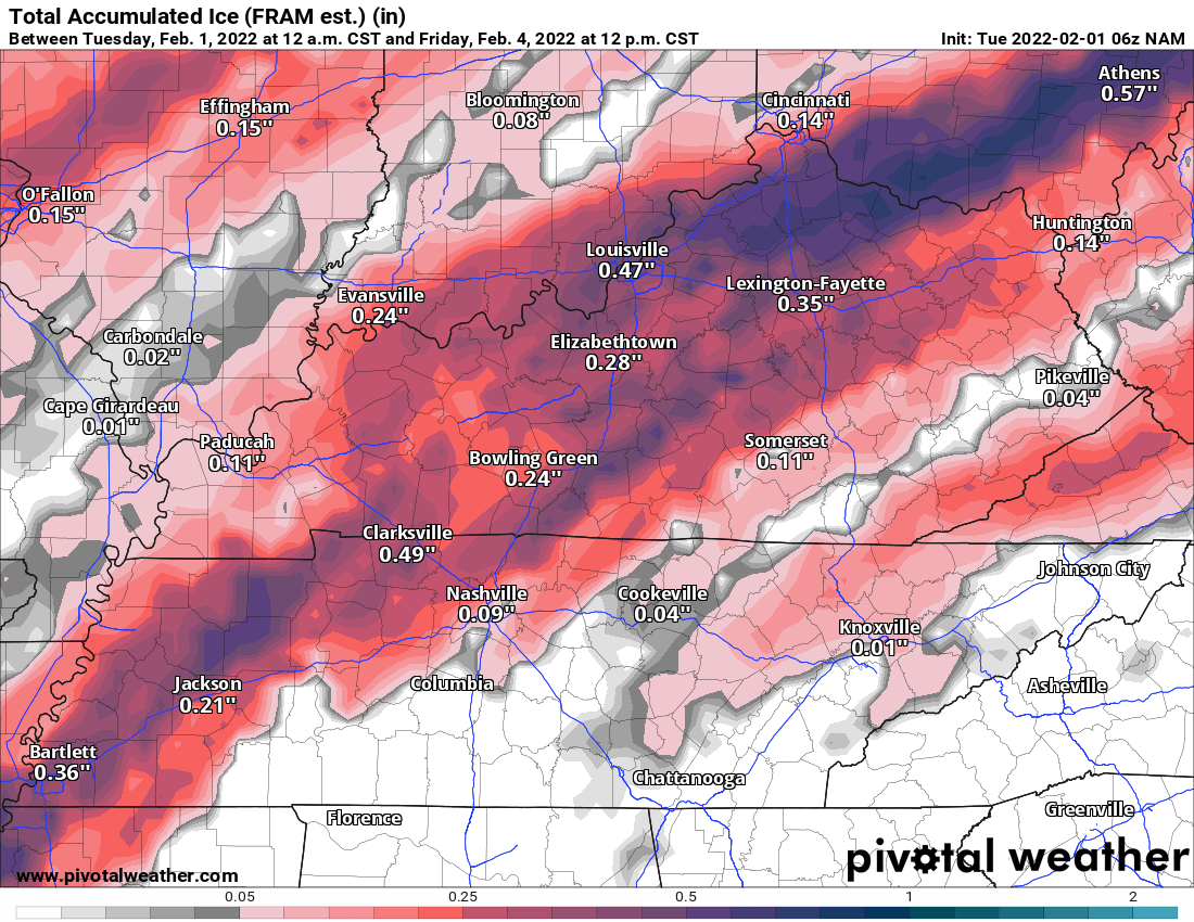
The last two maps are the latest run of the NAM. The GFS is definitely on the heavier side in terms of ice potential. I do want to continue to stress that it does not take much ice to cause major issues. Now is the time to go ahead and prepare for a potential ice storm. It would be a good idea to have a backup heating source as ice accumulation can cause power outages for some. Things are still kind of up in the air as to what area will take the biggest hit. A slight shift in the track of this system can make a big difference for some.
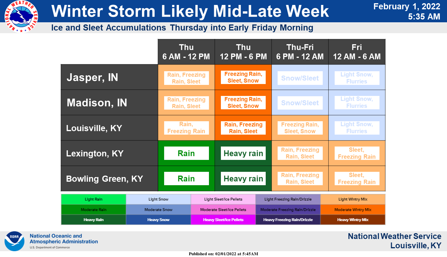
The Louisville National Weather Service Office posted the above graphic this morning. It looks like as of this moment the best timing for ice potential in the Lake Cumberland Area, is sometime late Thursday and into early Friday morning. I would not be surprised if that Winter Storm Watch is expanded to include Russell and surrounding counties at some point. I will be watching this closely and will post updates as more information comes in.