
Thursday was a quiet day weatherwise for the Commonwealth, but that will change beginning today and going into the day on Saturday. A frontal boundary will begin to move into the area later and that will bring with it the chance of showers and thunderstorms with a few strong to severe storms and the potential for flooding rainfall for some.
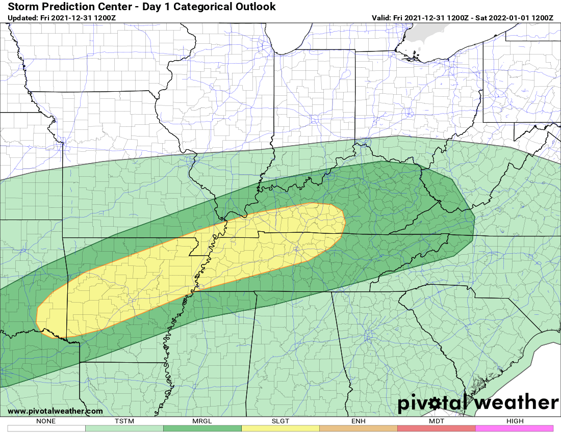
This is the severe weather outlook for today from the Storm Prediction Center. Most of the Commonwealth is in a level 1 Marginal Risk while the level 2 Slight Risk sits at Columbia and points west and southwest.
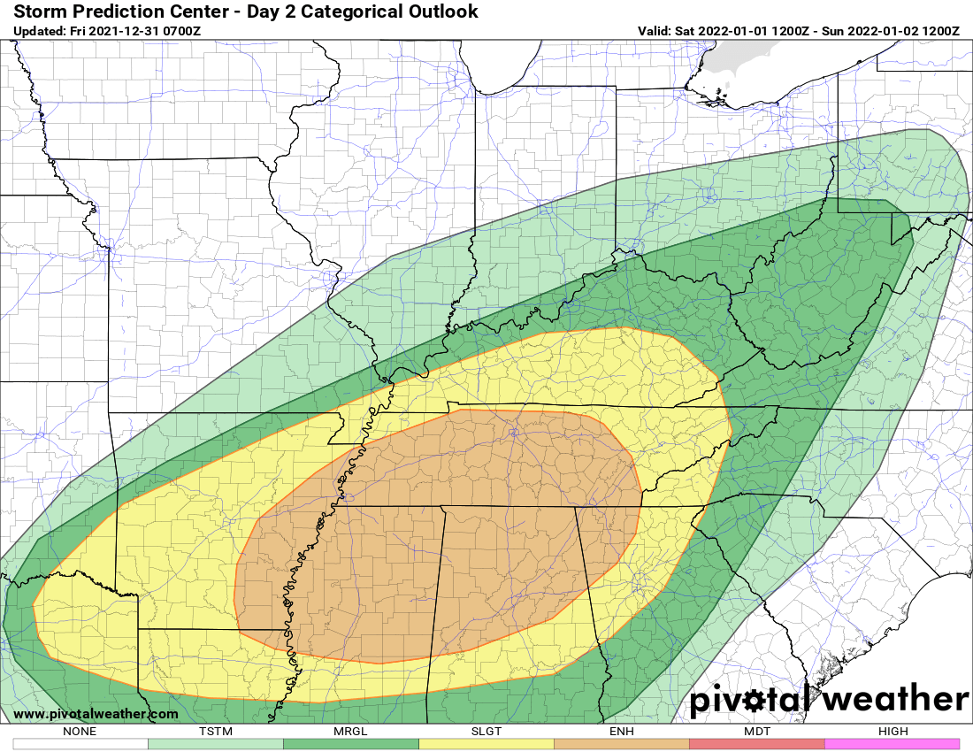
This is the severe weather outlook for tomorrow as it appears a better severe weather threat will be in place. SPC has all of central and southern Kentucky in a level 2 Slight Risk. Note, there is a level 3 Enhanced Risk posted just to our south in Tennessee and across parts of Mississippi, Alabama, and Georgia. Main threats with storms will be Damaging Winds and Isolated Tornadoes.
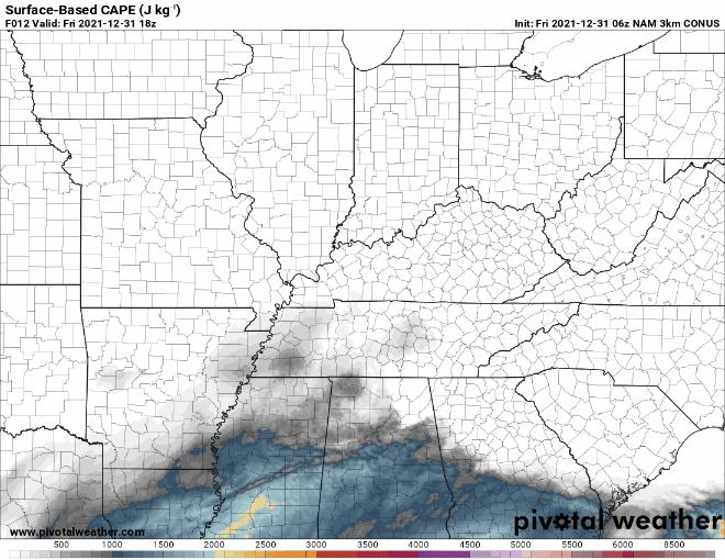
In all of my posts regarding the severe weather threat, you have seen me mention numerous times CAPE values across the region. This is the latest model run this morning, and you can start to see those darker colors coming into Kentucky, but the higher values are to our south. Like I have said though, you do not need a lot of CAPE for strong to severe thunderstorms. While nothing is off the charts, there is certainly enough energy for a few storms to turn severe.
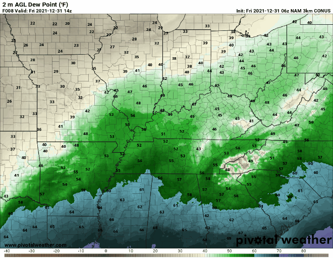
Check out that surge of moisture coming from the Gulf of Mexico. Dew points will quickly rise to the 60s today for Kentucky with deeper moisture to our south where the severe weather threat is higher. There will definitely be enough moisture in the atmosphere for showers and thunderstorms.
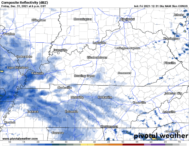
This is a look at the latest hour-by-hour radar. You can see showers and thunderstorms will increase in coverage later this evening with a few strong to severe storms. Then, on Saturday it appears a squall line will try to form associated with the cold front and push through the area. It looks like this will be our best threat for strong to severe thunderstorms. Keep in mind the radar will not exactly like this as this is a model that gives us an idea on where thunderstorms will develop.
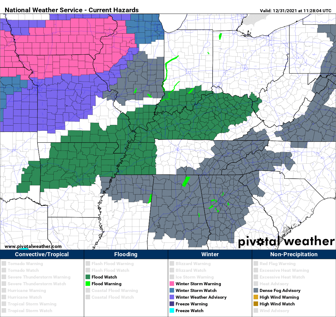
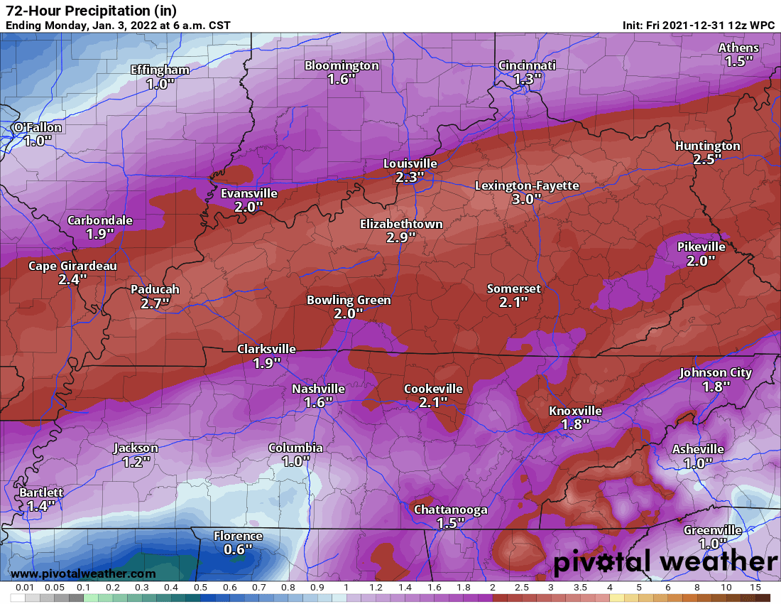
A Flood Watch is posted for much of Kentucky for tonight and going through Saturday. Some areas could receive 1-2 inches of rainfall with some isolated 3-inch amounts by the time this is all set and done.
My thoughts:
The big threat that I am noticing is obviously the flooding rainfall threat. Not expecting major flooding, but some areas could experience flooding issues especially in low-lying areas. The threat for sere weather is there especially for Saturday. Not expecting a major severe weather event or anything close to December 10th and 11th, but the threat is there. Make sure you have multiple ways of to receive watches and warnings. I will be watching this all weekend long and will update as new information arrives. Should any warnings be issued in the Lake Cumberland Area, I will be on the air providing severe weather information.