Good Wednesday, everyone. We are continuing to monitor the threat for severe weather today and into the evening hours. I want to stress that this is a “Marginal” threat. This is NOT the same type of setup we experienced earlier this month when Mayfield was struck by the EF4 tornado. We are talking about a threat in which a few isolated storms could reach severe limits…

The Lake Cumberland Area is now removed from the level 1 threat and into the thunderstorm category. We do note the level 1 threat is just to our south around the Kentucky and Tennessee border. Don’t get caught up in where the outlined area is though. There could be an isolated severe storm this afternoon, but as I mentioned in yesterday’s post, there is just not a whole lot of ingredients sufficient enough to produce severe storms for our area. The better dynamic support is well to our south across the Tennessee valley, northern Mississippi, and northwest Alabama.

This is a look at the available moisture around the region for today. The higher the dew point, the more moisture there is for the development of storms. Just as I showed yesterday, dewpoints remain much higher to our south in that area where the threat for severe weather is higher. Dewpoints across the Commonwealth will remain in the 50s with a few areas getting to 60. This is not necessarily the only factor in determining severe weather, but it does give us a pretty good idea on how volatile the atmosphere is.

Remember in my post yesterday when I was talking about CAPE values being low here? That is still the case this morning with the newest models. CAPE or Convective Available Potential Energy is another factor in determining the threat for severe weather. Once again, we see higher CAPE across the deep south where the severe weather threat is the highest. High CAPE values are not necessarily needed for severe weather. If you remember back on December 10th and 11th, the CAPE values were not very high for that event.
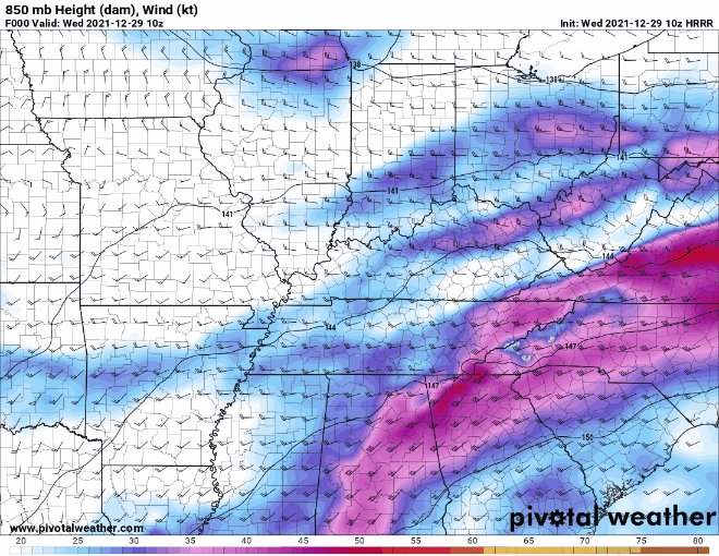
This map shows the upper-level winds in the atmosphere. When we had the December 10th and 11th event, the CAPE values were low, but the wind energy in the upper level was very strong. That is just not the case with this latest run of the models. The darker colors depicted on the map are across the deep south.
My Thoughts:
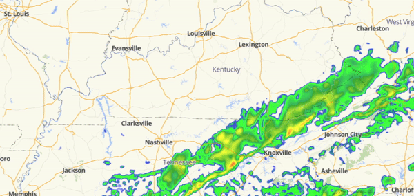
I do want to stress that the severe threat is not zero for today. However, this severe threat is completely conditional. There is nothing that I am seeing that jumps out to me as a big severe weather threat for today. The higher threat is clearly down south as I pointed out earlier and mentioned in the post yesterday. I will be watching for any changes and push updates as necessary. If there happens to be any watches or warnings issued for the Lake Cumberland Area, we will pass those to you. I will leave you with the latest hour-by-hour radar for the remainder of today.