
Good Monday morning, everyone! Hurricane Ida made landfall yesterday as powerful Category 4 in Louisiana. This morning, Ida has been downgraded to a Tropical Storm and will more than likely drop to a Tropical Depression later in the day. We are going to be watching the remnants of Ida come into our region tomorrow into Wednesday…
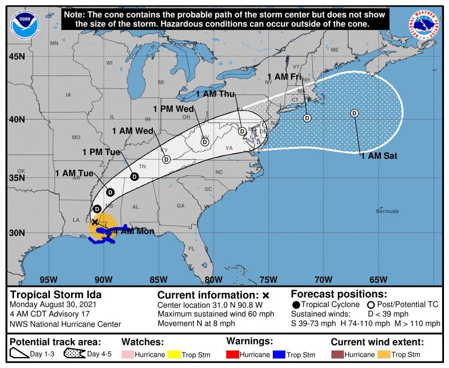
There’s the latest forecast track from the National Hurricane Center. You can see that cone has the remnants coming right over the state late Tuesday into early Wednesday morning…
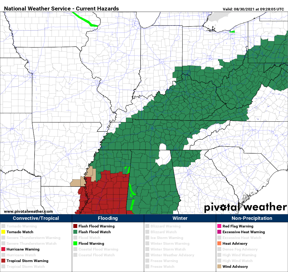
A Flash Flood Watch has been posted for much of the state, including the Lake Cumberland Area. The watch will go into effect Tuesday morning and be with us until Wednesday. Flooding rainfall is going to be a big concern with this system. Here’s the latest outlook from the Weather Prediction Center…
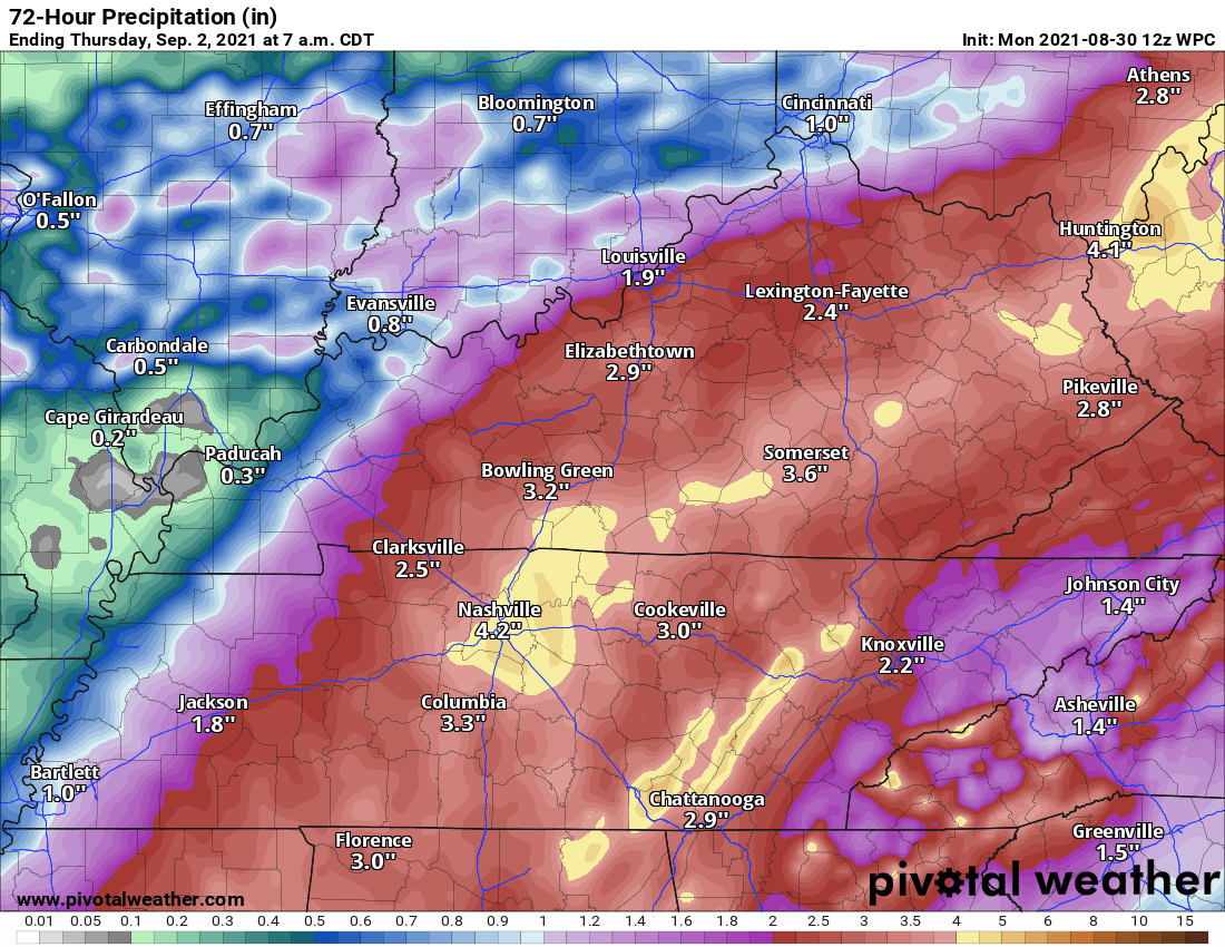
This latest forecast is predicting up to four inches of rainfall for some folks around the region. If you live in a low lying, flood prone area, please go ahead and make preparations in the event that your area becomes flooded. Here’s the latest hour-by-hour radar…
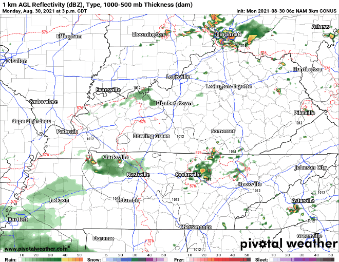
This latest run of the model has the rain starting late tonight into the early morning hours of Tuesday. A reminder, the radar will not exactly look like this as this is just an idea of when and where the activity will be. We will keep you up-to-date with the very latest and post updates as new information comes out.