
Happy Wednesday everyone and we are halfway through the work week. Starting out cold this morning as our temperatures are in the upper teens, but we will warm up today and should get close to 50 for the high today…

We are watching our next snow maker that will come into the area Friday night and into Saturday. Now that we are closer to Friday we can utilize the short range models and this is what we are seeing at this time…

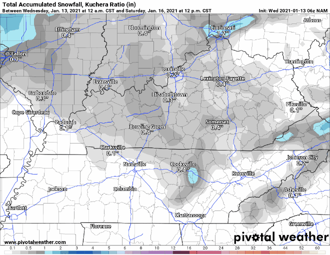
This is the NAM model and you can see it wants to bring an area of snow showers impacting much of central and southern Kentucky late Friday and into early Saturday. Now could this change? Absolutely and you’ve heard me say this hundreds and hundreds of times and that is winter weather is incredibly hard to predict as there are so many factors that can impact the rate of snowfall. I am not ready to put out a call for snowfall just yet, but here’s what some of the models are thinking right now in terms of what we could see starting with the NAM…
Here’s the GFS…
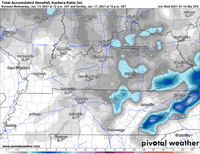
You can see that both models are actually pretty similar in terms of totals as of this morning. Now do not take this to the bank as so much could change between now and Friday and we will continue to watch as models update and we get closer. If everything continues to hold together, I will have a call for snowfall on tomorrow’s blog post. Have a wonderful day and stay safe!