
The difficult weekend winter storm that impacted the region has now moved on, and we now set our sights on the next system. We should get most of the snow out of the area today as sunshine returns bringing temperatures above freezing to 43 degrees. An artic front will move into our area tomorrow bringing showers and then a quick changeover to snowfall.
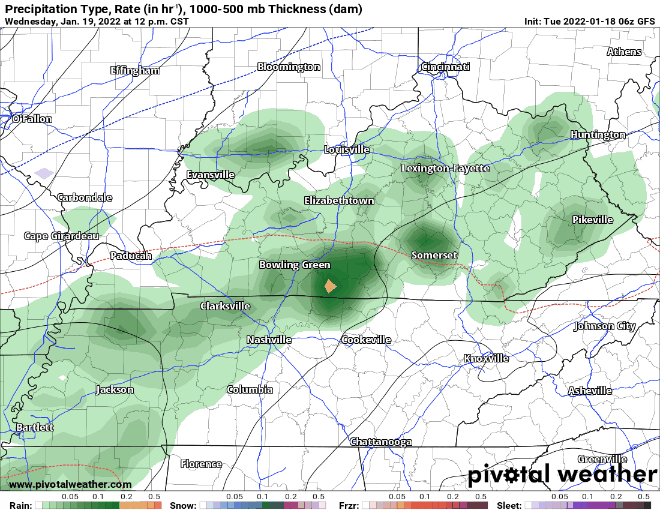
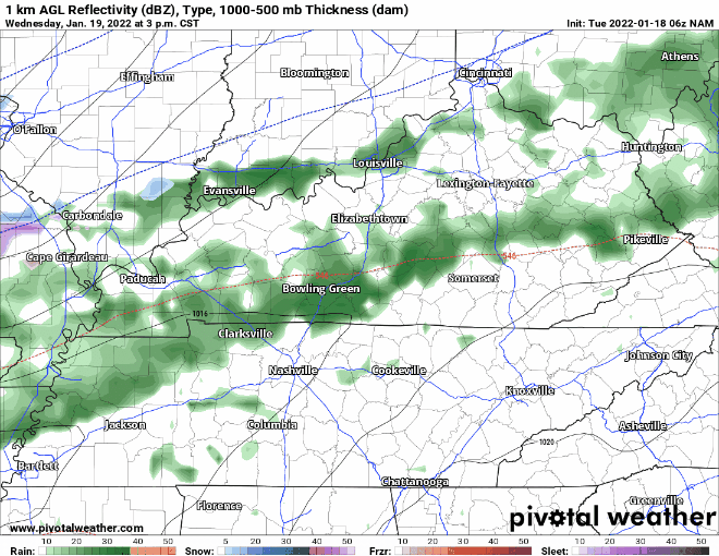
Both the GFS and the NAM show rain and then a switch to some possible mixed precipitation and then snow. The models at this time are indicating a bigger swath of snow for Central Kentucky with lighter accumulations to the south.
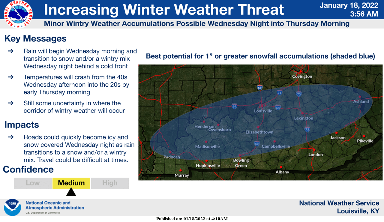
The National Weather Service in Louisville agrees with this thinking. Things could change as we know with these winter systems, but I think the switch will happen quicker to our north which will give those folks a better chance of seeing more in the way of snow accumulations.
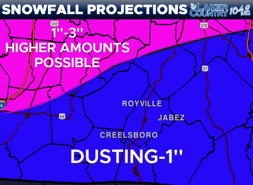
This is my latest thinking on the next snow system. Don’t take these projections to the bank as they are just a forecast. This is subject to change and if that does, I will make sure to post an update. Have a great Tuesday!