
Good Tuesday folks and I hope all of you are safe and warm today. We have just went through our second winter storm in less than a week that brought mostly ice to the region yesterday with just a little bit of snow. If you do not need to be out today please just stay at home and be warm. I want to focus on the next winter storm because it is certainly looking interesting for sure. Before I get to much into it I want to say that winter weather in Kentucky is always changing and this will probably change more as we go through the day. With that in mind let’s start looking at some weather models beginning with the GFS…

This is the precipitation version of the GFS. You can see we will get some snow shower early on Wednesday before the main stuff comes in late Wednesday night and into early Thursday morning. Now here’s is what the GFS is thinking in terms of snow totals…

This run of the model has most of the area in that 1-3inch category with locally higher amounts possible. Now I want you to check out the NAM because it goes quite heavy on the snowfall…
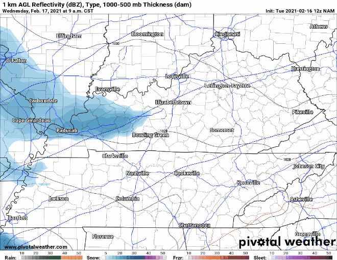
You can see the Lake Cumberland Area and most of Central Kentucky get blasted with snowfall with mostly rain, sleet, and freezing rain over in the eastern part of the state. Here’s the projected totals from the NAM…
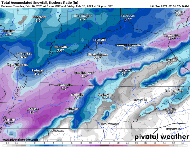
The NAM is going very heavy on snowfall totals projecting upwards of 5-6 inches in parts of the region. Now these models are not in agreement and quite frankly I think the NAM is a tad bit on heavy side. I am going to have to watch the next run of models that will come in later today and see how they fare in comparison to this run. Not ready to put out a call for snowfall just yet, but I will get to that later. Stay safe out there everyone and I will make updates to this post as additional data comes in.