
Good morning everyone and I hope you have had a wonderful week thus far. We are keeping an eye closely on the weather as it continues to look like we will be getting in on significant ice accumulation. We have been watching this for the last several days and while early on it appeared the worst was going to stay to our north, that has now changed. Here’s the latest future radar…

You can see that pink area comes in late tonight into the early hours on Wednesday and it just comes right over most of the Lake Cumberland Region bringing with it the possibility of significant ice accumulation. This is very concerning because as compared to snow, ice can cause a number of issues besides travel like power outages and tree damage. I want to show you another model that is predicting ice accumulation totals and this latest run is very concerning…
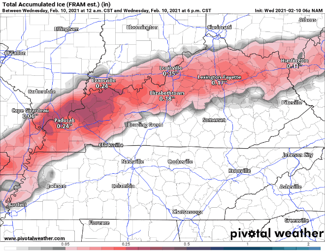
This latest run is pushing a lot of folks over a half an inch of ice which is very significant with local higher amounts possible. We are going to continue to monitor this situation closely hoping that this will be a bust and we see nothing but just normal rain. Make sure and stay tuned on here and on that air at 104.9 fm.