
Good evening, everyone. Just wanting to hop on here and provide a quick update on the severe weather threat. We are continuing to monitor the threat for strong to severe thunderstorms. Western Kentucky has seen several tornado warnings so far, and this will continue over the next several hours. Here’s the latest severe weather outlook from SPC…
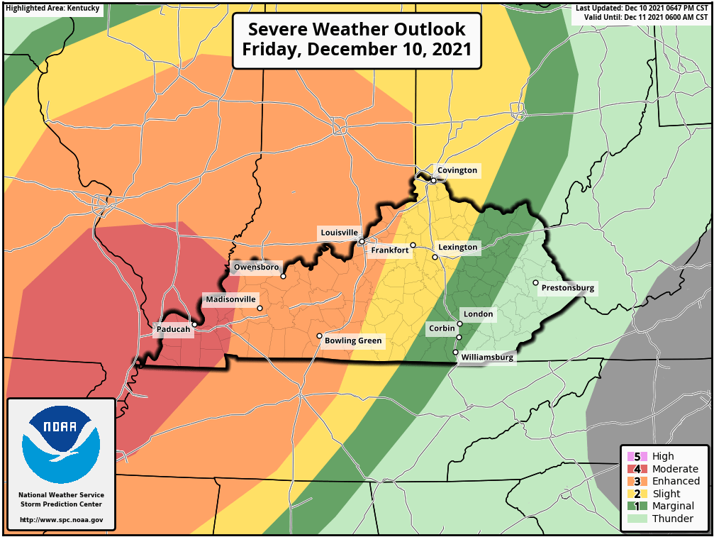
The Lake Cumberland Area is in that yellow level 2 Slight Risk for severe weather. Do not get caught up in the colors on here. Storms do will not magically weaken just because they move from an orange zone to a yellow zone. The main timeframe for severe weather in our area will be between 11:00 p.m. to 9:00 a.m. Here’s the latest hour-by-hour…
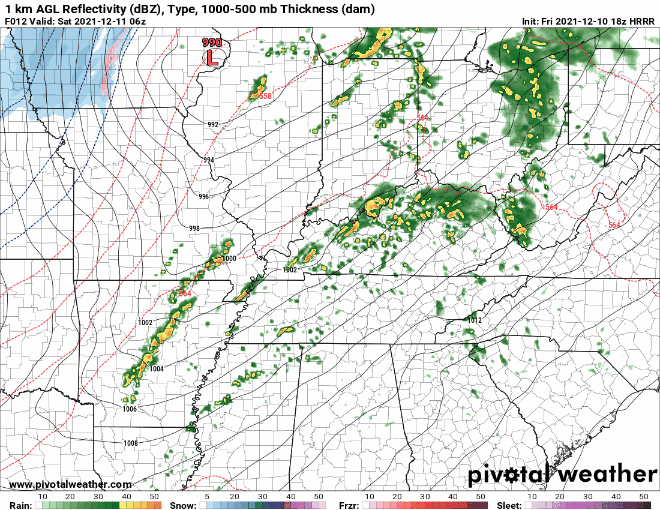
We have to keep a close watch on any individual thunderstorms that try to form as these have a better chance of producing tornadoes. The main event will come in the form of a squall line that will bring with it the potential for damaging winds and a few isolated tornadoes. Keep it tuned in to Laker Country 104.9 for the very latest.