
Happy Thursday, everyone. It has been a little while since I last made a weather post as it has been a quiet weather pattern for a while. It looks like that will change as a strong front is expected to move through the area late tomorrow night and early Saturday morning, bringing with it the chance for strong to severe thunderstorms. Here’s the latest severe weather outlook from the Storm Prediction Center as of 6:00 Thursday morning:
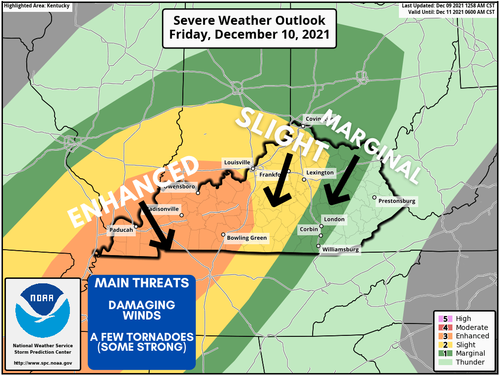
Russell and surrounding counties are at a level 2 slight risk for severe weather, while an enhanced risk is posted just to our west. Eastern Kentucky is at a level 1 marginal risk as storms will be much weaker in that portion of the state. Ahead of the front, temperatures will be well into the upper 60s and lower 70s on Friday. Unfortunately, it does appear this will be an overnight event while many of you are sleeping. Here’s the latest model guidance…
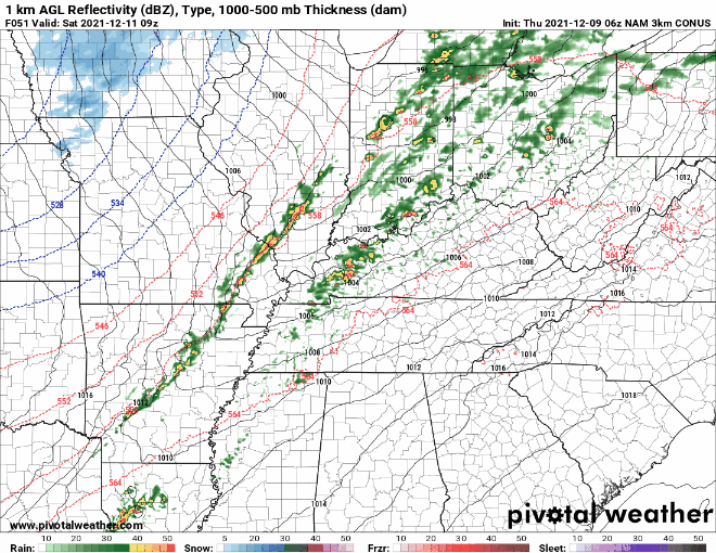
This continues to show the best chance of storms arriving late Friday night and especially early Saturday morning. I want to show you this model, which is called the Significant Tornado Parameter (STP)…
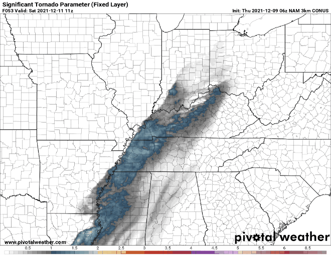
You can see that area in a line still holding together as it moves into the Lake Cumberland Area, which does mean there is a threat of a few tornadoes. A few of these tornadoes could be strong, especially across western Kentucky. We will keep you updated as more information comes in and will provide severe weather coverage should any watches or warnings come out for our area. Since this appears to be an overnight event, please make sure you have a way of getting a warning to wake you up.